
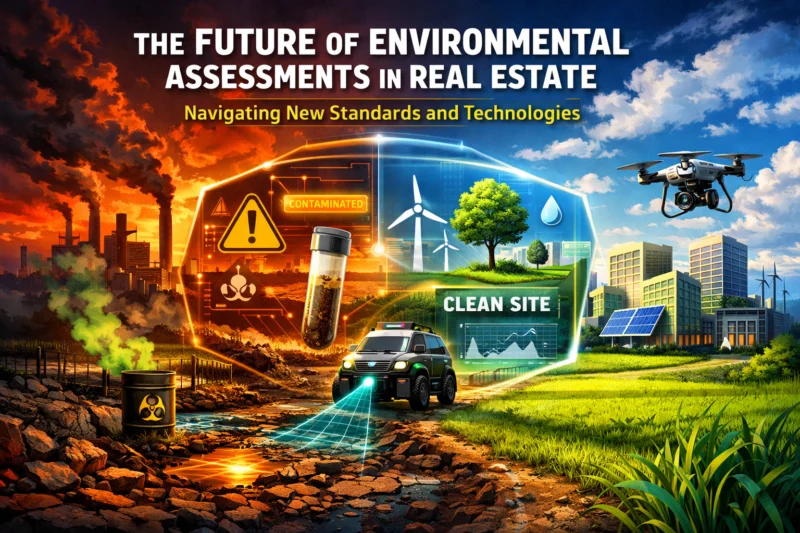
Real estate deals are moving from “paper compliant” environmental due diligence to evidence you can defend under tighter lender, insurer, and regulatory expectations—so stakeholders now need the future of environmental site assessments to be planned up front, not retrofitted at closing. In 2026, that means aligning project goals and risk tolerance with updated ASTM-aligned practice, clearer all-appropriate-inquiry documentation logic under 40 CFR Part 312 (AAI), and technology-enabled data workflows that still produce regulatory-ready conclusions. If you own, finance, underwrite, or develop property, the practical next step is to confirm what your stakeholders will rely on (deliverables, traceability, and limitations) before fieldwork begins—and to build a decision path for when Phase I is not enough. This article explains how to navigate new standards and real-world technologies without losing defensibility.
What’s changing in real estate environmental due diligence (and why it affects decisions)
The future of environmental site assessments is being shaped less by “new tests” and more by changing expectations about what counts as defensible evidence in real transactions. Environmental risk is increasingly treated as a financing and permitting input—because findings can affect loan underwriting, disclosure positions, redevelopment feasibility, and the confidence lenders and insurers require when timelines are tight. As a result, owners and borrowers are rethinking traditional workflows that relied heavily on generic scope templates and site sampling assumptions.
Several drivers are pushing this shift. First, historic land use is receiving deeper scrutiny because many parcels have complex development histories—dry cleaners, rail sidings, fill placement, leaking underground utilities, or periodic industrial operations that may not be fully reflected in accessible records. Second, lenders and insurers are demanding cleaner documentation packages: consistent interview notes, better source traceability, and clearer articulation of limitations and uncertainty. Third, regulators and counterparties are increasingly aware that “no evidence of contamination” is not the same thing as “no risk,” so the industry is focusing more on how conclusions are supported.
In practice, this means the workflow is trending from a “sampling-first” mindset toward a structured evidence-building approach: historical research and stakeholder interviews establish context; targeted investigation is then triggered only when it makes decision sense; and the final report ties findings to a defined set of assumptions. That evidence-based workflow is where technology starts to add value—GIS, geophysics, imagery, and digital documentation can help you narrow targets and strengthen your narrative, but only if the output is integrated into the ASTM-aligned Phase I framework and presented with credible methodology.
A key nuance many teams miss is that newness in technology does not automatically equal newness in acceptance. A drone photo mosaic or a geophysical anomaly might be compelling, but the decision-makers (lenders, counsel, regulators, and permitting agencies) still care whether the underlying evidence is linked to the inquiry logic, the site-specific scenario, and the appropriate reporting structure. For example, a developer might use high-resolution imagery to identify signs of staining near an existing loading dock, but unless the report explains how that observation fits the Phase I conclusions and when it should trigger Phase II or additional inquiry, it may not improve defensibility.
What stakeholders should do next is practical: ask your assessment provider how they plan to produce decision-ready deliverables, not just test results. Confirm that the project will maintain a traceable record trail from sources to interpretation, explain limitations clearly, and support a documented rationale for both “no additional work” outcomes and “Phase II recommended” outcomes. You also want a provider who can communicate uncertainty in a way that aligns with lender or counsel expectations, since that communication often determines whether findings become a financing obstacle or a manageable risk item.
In 2026, navigating environmental due diligence starts with understanding how ASTM E1527-21 structures Phase I ESA expectations and how 40 CFR Part 312 (AAI) frames the all-appropriate inquiry logic that liability protection depends on. Even when technology improves your ability to find context clues, the “decision backbone” still relies on the standard’s inquiry and reporting discipline—what was reviewed, who was interviewed, what was observed, and what conclusions are defensibly supported.
ASTM E1527-21 is the industry’s primary method for organizing Phase I ESA components, including the historical review, site observations, and interview process. Why it matters is straightforward: lenders, counsel, and regulators typically look for consistency between the report structure and what a defensible Phase I should include. When an ESA provider follows ASTM’s approach, it becomes easier for stakeholders to evaluate whether the report’s conclusions are reliable enough for underwriting and risk allocation.
How it works in real projects: the Phase I report should document the sources reviewed, the information gaps (if any), and how the site’s current condition aligns with historical land use. Practical application looks like ensuring your historical sources are not just collected, but actually reviewed for relevance to the parcel and surrounding areas. It also means your interview records (who was contacted, what was asked, and what was learned) are preserved with enough detail to explain how uncertainty was handled.

The relationship to 40 CFR Part 312 (AAI) is where many teams need clearer guidance. While ASTM provides a method commonly used to satisfy Phase I expectations, AAI is a federal concept tied to liability protection under CERCLA. That means documentation quality and how the inquiry is conducted matter—not only whether a Phase I report exists. The practical takeaway is to treat AAI concepts as “documentation logic”: if the report’s evidence trail shows reasonable inquiry efforts, the stakeholders have more confidence that the record supports defensibility.
Deeper insight comes from common misreads. One frequent mistake is thinking that any Phase I report automatically satisfies AAI expectations without scrutiny of limitations, record gaps, or reliance assumptions. Another common error is relying on narrow or mismatched records—such as focusing on the property’s immediate address record when evidence suggests that operations occurred through a broader easement, leased parcel, or off-site utility corridor. Edge cases that deserve special attention include boundary changes, newly discovered improvements (e.g., a buried tank revealed during redevelopment planning), and missing historical data where the provider must explain why limitations do not defeat the report’s conclusions.
If you’re selecting a consultant, ask what they do to ensure alignment in both structure and substance. Specifically confirm how they handle reliance on third-party records, what their approach is when historical sources are incomplete, and how they reflect those realities in conclusions and recommendations. The goal is not to “get a report,” but to build a defensible record that supports underwriting and permitting conversations.
Achieving defensible answers: a decision-path framework for when to expand beyond a Phase I
A Phase I ESA is often necessary, but it is not always sufficient for the decisions real estate stakeholders must make. The future of environmental site assessments points toward better decision pathways—where teams use Phase I results and contextual risk factors to determine when to expand beyond Phase I into fit-for-purpose follow-on work. The key is not to over-test, and not to under-invest; it’s to document why a scope expansion (or decision not to expand) matches the project’s actual risk scenario.
A decision-path framework typically starts with initial screening: assemble the Phase I report record, verify current site conditions align with reported history, and identify recognized environmental conditions (RECs) and de minimis conditions. Next is risk triage, where you categorize how serious and actionable the potential risks are given the intended use—industrial redevelopment versus sensitive receptor planning (schools, daycare, healthcare) can change what “significant” means. Then you identify targeted investigation triggers, such as apparent RECs, mismatches between historical records and current observations, and areas where vulnerable receptors could be affected.
How it works in practice is easier when you treat the decision as an evidence loop rather than a binary “Phase I yes/no.” For example, if Phase I interviews suggest past disposal practices but documentation is incomplete, the follow-on scope might include targeted soil or groundwater sampling near locations implied by credible historical sources, rather than blanket sampling across the entire property. If the concern involves vapor intrusion pathways, the follow-on work may include screening consistent with the receptor and exposure scenario, then escalation only if data indicates a stronger need.
Tradeoffs and limitations matter. Over-scoping can create unnecessary disruption, uncover incidental findings that trigger broader remediation obligations, and increase cost without improving the decision. Under-scoping is equally risky: if the team misses off-site sources, ignores reasonable changes since the report date, or fails to interpret limitations, stakeholders may discover gaps later—often after lender timelines and permitting schedules have already been set.
Real-world scenarios show why documentation is central. A lender may require additional data if Phase I identifies a REC with a plausible pathway to the intended use, while a developer might pursue confirmatory work to quantify redevelopment feasibility before investing in design changes. In other cases, the defensible conclusion might be “no further investigation warranted” because the REC is inconsistent with site observations, historical sources are weak or contradicted, or the planned development scenario eliminates the relevant exposure pathway.
Deeper insight: what most guides get wrong is presenting follow-on work as a universal “Phase I → Phase II” ladder. In reality, expansion must be triggered by fit-for-purpose needs. The best practice is to document your rationale for either step—what evidence supported the decision, what uncertainties remain, and how those uncertainties are expected to be handled in the business plan. That approach reduces rework and improves consistency across underwriting, permitting, and legal review.
Technology reshaping how environmental evidence is gathered (GIS, GPR, drones, and digital workflows)
Technology is changing how environmental due diligence teams gather and organize evidence, but it does not replace the standards-based inquiry logic that keeps conclusions defensible. In the future of environmental site assessments, tools like GIS, GPR, drones, and digital workflows are most valuable when they help improve target selection, strengthen land-use narratives, and maintain transparent evidence traceability—while still aligning with ASTM E1527-21 inquiry expectations.
GIS and historic mapping spatial analytics help teams connect land-use history, parcel boundaries, and surrounding operations. Why it matters is simple: better spatial context can reveal whether a past operation plausibly affected the subject property through runoff, fill placement, subsurface migration pathways, or utility corridors. Practical application includes overlaying historical sources (such as historical land-use layers and aerial imagery) with current site features to identify where “reasonable inquiry” should focus. The tradeoff is that GIS overlays can be wrong due to datum issues, outdated boundary layers, or misalignment between historic maps and current surveying—so GIS output must be validated, not treated as a certainty.
GPR and other geophysical methods can support subsurface screening and utility mapping, especially for identifying voids, buried structures, or potential anomalies. How it works depends on the equipment and interpretation, and it comes with limitations: GPR cannot reliably confirm contamination presence by itself, and utilities can create false positives. Practical application is to use geophysics to guide where invasive sampling or direct verification should occur, then to document methodology, calibration, and interpretation assumptions. Deeper insight: many teams misplace “confidence” by reading anomalies as evidence of contamination rather than evidence of something buried that may or may not relate to historical risk.
Drones and imagery can strengthen ground truthing by documenting vegetation patterns, erosion features, staining indicators, stressed surfaces, or changes since historical records. Digital workflows and data platforms then help preserve an audit trail through version control, field photo indexing, report amendments, and chain-of-evidence organization. This improves defensibility because stakeholders can see what data was collected, when it was collected, and how it was used to support findings.
Edge cases highlight where technology must be handled carefully. If a redevelopment contractor has changed grade levels since the report was prepared, drone imagery might show conditions that do not match the report’s assumptions; in that situation, the “future of environmental site assessments” should include an update strategy, not just new images. Another common failure mode is “tool-first” scoping—starting with a favorite dataset or method while skipping the fundamental land-use research and interview logic that standards-based inquiry requires. The defensible approach is tools-as-support, not tools-as-substitute.
When adopting technology in 2026-ready projects, ask how outputs will be integrated into the report’s narrative. Specifically: what calibration and quality checks exist for geophysical outputs, how imagery is geo-referenced and labeled, how datasets are versioned for auditability, and how uncertainty is communicated in conclusions. The winning posture is credible, transparent evidence-building that aligns with how lenders and counsel evaluate risk.
Choosing among assessment approaches and alternatives (what to look for in 2026)
In 2026, choosing the right environmental assessment approach is less about finding the “most advanced” method and more about matching scope to decision needs, risk scenario, and evidence quality. While the Phase I ESA remains a core tool, the future of environmental site assessments includes smarter selection of when to run confirmatory Phase II work, when to do targeted expanded due diligence, and when voluntary screening or enhanced investigations may be warranted by lender or insurer expectations.
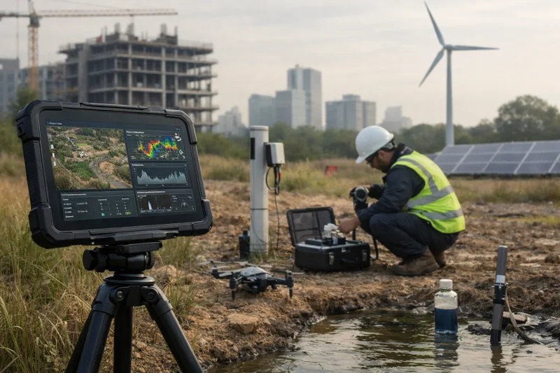
Start by considering realistic approach categories. Many projects use the ASTM E1527-21 Phase I ESA followed by confirmatory Phase II only when triggers indicate it’s needed. Other projects benefit from targeted expanded due diligence, such as narrower sampling in localized areas when land-use history is clear but risk appears confined to a subset of the parcel. Still other scenarios—often driven by lender underwriting, insurer requirements, or redevelopment risk—may justify voluntary screening or enhanced investigations that go beyond baseline Phase I inquiry.
Selection criteria should be evidence-and-documentation oriented. Evaluate provider credentials and QA/QC practices, not just report templates. Confirm how they handle documentation standards, how they preserve chain-of-evidence and dataset provenance, and how they report uncertainty and limitations. Practical application for buyers is to request a “deliverables map” during scoping: what appendices will exist, what historical sources will be included, what site observations will be documented, and what decision logic will be used to recommend follow-on work.
Deeper insight includes when enhanced work backfires. If expanded investigations uncover incidental findings unrelated to the intended exposure pathway, you may trigger remediation obligations or disclosure complications that do not improve the business decision. A common mistake is to interpret “more data” as “better outcome” without evaluating whether the additional data reduces the key decision uncertainty. The best providers tie expanded work directly to the receptor and use-case scenario, then document why the outcome matters to underwriting and permitting.
Deliverables checklist items typically include the Phase I report with clear conclusions, a separate appendix capturing historical source review and interviews, site observation documentation, and explicit listings of limitations and assumptions. For projects that move beyond Phase I, the deliverables should also include sampling rationale, lab or method QA details, and interpretations tied to fate/transport or exposure logic where appropriate. These materials are decision-use artifacts; they are what counsel and lenders look for when they assess defensibility.
Finally, adjust approach by geography and market reality. Since properties vary by land-use history—from mixed industrial zones to older residential corridors with historic commercial operations—your provider should be able to demonstrate how their inquiry approach adapts to regional patterns (while still aligning with standards). Ask what “typical risks” exist in the region and how their method accounts for them without turning the scope into a generic box-check exercise.
Common pitfalls, misconceptions, and litigation-adjacent risks
One of the biggest pitfalls in environmental due diligence is misunderstanding what a Phase I ESA can and cannot guarantee. A Phase I report does not guarantee there is no contamination; it documents the results of a defined inquiry and explains conclusions based on the evidence reviewed and observed. Confusing those meanings can create avoidable financing delays and disputes—especially when stakeholders later disagree over whether the inquiry was “reasonable” for the project.
Under-scoping is another high-risk failure mode. Common examples include failing to account for off-site sources, not capturing meaningful changes since the report date, or omitting relevant interviews that would have resolved key uncertainties. If redevelopment planning changes the receptor scenario—such as moving from light commercial use to a more sensitive use—then the previous assumptions may no longer match the decision. In that case, stakeholders should treat the update process as part of the defensibility strategy, not as an afterthought.
Documentation problems often trigger disputes even when sampling results are favorable. These include not maintaining evidence, not addressing limitations explicitly, or using inconsistent definitions of RECs and other conditions in the reporting narrative. Deeper insight: most guides focus on “what to test,” but litigation-adjacent risk frequently comes from weak explanation of methodology and reasoning rather than the presence or absence of contaminants. In other words, the story of how conclusions were reached matters as much as the conclusion itself.
Timing and reliance logic also matter. If a buyer relies on a Phase I report for underwriting but the site changes after preparation—new construction, demolition, additional grading, or new documentation becomes available—the reliance might be questioned if the report’s assumptions no longer match reality. Similarly, off-site complexity can produce residual uncertainty when data access is constrained; the defensible approach is to document what was sought, what was unavailable, and what that means for conclusions.
Practical risk mitigation starts with clearer communication during scoping. Request explicit assumptions, limitations, and a rationale tied to each conclusion. Confirm lender and insurer expectations up front so you don’t discover later that they require specific deliverables, a higher documentation threshold, or a particular report structure. When teams set expectations early, the probability of rework declines because the report is built to the audience that will rely on it.
Edge case to consider: a report may be technically sound, yet still trigger concerns if it does not clearly separate “observed conditions” from “potential conditions inferred from history.” If the narrative is ambiguous, counsel and lenders may escalate for additional inquiry. The best providers reduce this risk by writing conclusions that map evidence to the decision logic clearly and consistently.
Advanced considerations beyond the basics: updates, boundary changes, and stakeholder objections
Environmental due diligence doesn’t end when the report is issued—real estate projects require a plan for updates, boundary nuances, and how to handle stakeholder disagreement over scope. In 2026, navigating the future of environmental site assessments means treating the ESA record as a living decision artifact, where new information might require an addendum, an expanded scope, or a documented update rather than a fresh restart.
Updates are triggered by more than just new sampling results. Typical triggers include newly discovered improvements or subsurface features, changes in site condition, evidence that contradicts historical narratives, or timing gaps between report preparation and key decision points. How this works practically is to define an update logic during the scoping stage: what kinds of changes require an addendum, which changes warrant Phase II, and who decides whether updates are necessary given lender and counsel reliance requirements.
Boundary and ownership issues can also change the inquiry footprint. Property line changes, easements, leased areas, and construction-stage work within or adjacent to the subject parcel all influence what must be included in the inquiry. A common mistake is to treat the “address on the report” as the boundary forever, even when redevelopment plans shift boundaries or access points. For defensibility, the assessment team should document how the site control and relevant areas were determined and how they affect conclusions.
Managing stakeholder objections is a frequent real-world challenge. Developers might question why additional scope is needed; lenders might require stronger evidence for RECs; counsel might push for tighter limitations language; and insurers may want clearer risk pathways documentation. Deeper insight: disagreements often happen because stakeholders interpret “reasonable inquiry” differently. The defensible approach is to anchor discussion in documented assumptions and limitations, then show how those assumptions map to the decision criteria used by underwriting and permitting.
Off-site complexity adds another layer when neighboring property history is significant but data access is constrained. In those cases, evidence-gathering should include steps taken to obtain relevant records, what attempts were made, and why conclusions reflect residual uncertainty. Edge cases include older fill, undocumented underground utilities, informal dumping histories, demolition artifacts (e.g., buried debris), and redevelopment that changes vapor pathways or exposure assumptions. When these issues arise, the update strategy and clear documentation become central to avoiding rework and disputes.

Optional comparison (example for internal discussions): teams often benefit from a side-by-side view of when updates vs expansions are appropriate based on new evidence type—field observation changes, new records, timing gaps, or intended use changes. When creating such a table for internal use, keep it decision-oriented and tied to documented reliance and uncertainty.
Data integrity and defensibility: building an evidence trail that survives scrutiny
Defensibility in 2026 hinges on data integrity: an assessment is only as persuasive as the chain of evidence from sources to interpretation. The future of environmental site assessments increasingly rewards teams that can demonstrate traceability, quality control, and coherent reasoning—because that is what lenders, counsel, and auditors scrutinize when they assess risk. Building that evidence trail is both technical and procedural: it requires documentation discipline and good governance for how files, datasets, and report versions are managed.
What “defensible” means in practice is traceability from sources to interpretations to recommendations. Historical source quality matters: entries should be relevant, dated, and tied to the inquiry logic. Field observation standards matter: photos, notes, and descriptions must be specific enough that another professional could understand what was seen and why it was meaningful. For tool outputs such as GPR or remote sensing, defensibility depends on calibration, methodology descriptions, assumptions, and validation against on-the-ground evidence where feasible.
Quality assurance and quality control should be visible in the record, not implied. Provider teams should clearly document methodology, any limitations encountered during collection, and how uncertainties are reflected in conclusions. Practical application for real estate teams is to request a “documentation package” approach: ask what evidence artifacts exist beyond the final report PDF, such as interview notes, source lists, field logs, calibration records, and dataset provenance. This is also where digital workflows help—version control and audit trails can prevent later confusion over which version of a dataset supported which part of the report.
Data governance for multi-stakeholder projects is another critical piece. Real estate transactions often involve brokers, attorneys, lenders, environmental consultants, and redevelopment teams working across time and platforms. The defensible approach includes secure sharing protocols, consistent naming conventions, metadata preservation, and controlled access to evidence artifacts. Deeper insight: digital platforms can improve defensibility when they preserve provenance, but they can harm it when automated overlays are created without human review or when imported datasets lack documentation. A tool that “looks right” is not enough; defensible evidence needs provenance.
Tradeoffs exist because stronger governance can add process steps. However, the payoff is reduced rework, fewer disputes over assumptions, and faster alignment across underwriting and permitting. Real-world scenario: if a lender asks why a site condition was not treated as a REC, the provider should be able to point to specific observation logs and source review notes. That speed and clarity often determine whether the transaction stays on schedule.
To build a durable evidence trail, set expectations early: clarify what evidence artifacts will be provided, how version updates will be tracked, and how limitations will be documented. Then ensure your internal team knows how to manage the record so that “future of environmental site assessments” work stays usable when the project reaches permitting or financing milestones.
Frequently Asked Questions About The Future of Environmental Assessments in Real Estate
Will ASTM E1527-21 require different Phase I workflows than older ASTM versions?
ASTM E1527-21 can affect how teams structure and document the Phase I ESA, especially around the organization of inquiry elements, reliance discipline, and how information is reflected in conclusions. In practice, consultants may update their historical source review approach, reporting conventions, and how they record limitations and evidence gaps so they map clearly to the standard’s expectations. Buyers and lenders should confirm with their consultant that their report narrative and appendices align with E1527-21 structure, not just “old Phase I style” formatting.
How does 40 CFR Part 312 (AAI) affect what lenders expect from a Phase I ESA?
While lenders generally rely on a defensible Phase I report to support underwriting, 40 CFR Part 312 (AAI) influences the documentation logic behind liability protection concepts. That means lenders often pay close attention to whether the report demonstrates reasonable inquiry efforts and clear articulation of limitations. In practical terms, a Phase I with strong evidence traceability—sources reviewed, interviews documented, and observations explained—typically aligns better with how lenders and counsel evaluate AAI-related defensibility.
Can technologies like GPR or drones replace Phase I environmental site assessments?
No—GPR and drones can support evidence gathering, but they generally cannot substitute for the ASTM-aligned inquiry and reporting discipline required for a defensible Phase I ESA. GPR results are screening signals that need interpretation and validation, while drones provide imagery that must be connected to the inquiry logic and current site conditions. A defensible approach uses technology as support for land-use reasoning, target selection, and documentation traceability, with conclusions still grounded in the Phase I framework.
What triggers a decision to move from Phase I to Phase II investigations?
Common triggers include apparent RECs, mismatches between historical records and current observations, and situations where vulnerable receptors or exposure pathways make a localized concern decision-relevant. Timing changes—such as new observations revealed during redevelopment planning—can also trigger escalation if they affect assumptions used in Phase I conclusions. The decision should be documented as part of risk triage, including why additional sampling or screening addresses the specific uncertainty identified in Phase I.
How should we handle updates if property conditions change after the report is issued?
When property conditions change, teams should determine whether the change requires an addendum, an expanded scope, or a new inquiry component. Key triggers include newly discovered improvements or subsurface features, grading changes that alter pathways, and new information that contradicts or clarifies the Phase I record. Managing reliance/timing is critical: stakeholders need a clear explanation of what changed, what evidence supports the update, and whether conclusions remain valid.
What are the biggest misconceptions about environmental site assessments and contamination liability?
The biggest misconception is believing a Phase I ESA guarantees there is no contamination. In reality, Phase I supports a defensible conclusion based on evidence reviewed and observed within the defined inquiry framework, with residual uncertainty possible. Misunderstandings also happen when stakeholders treat “no evidence found” as “no risk,” rather than recognizing the role of limitations, off-site complexity, and conditions that may change after report preparation.
What should a buyer request to evaluate whether an assessment scope is “defensible”?
A buyer should request clear documentation of what sources were reviewed, what interviews occurred (and what they found), and how site observations relate to historical land use. They should also ask for explicit limitations and assumptions, plus evidence of QA/QC for any technology outputs used to inform the narrative. Practically, “defensible” scope means the report explains the rationale behind each conclusion and supports decision-use needs for underwriting and permitting discussions.
How do you balance doing enough investigation with avoiding unnecessary disruption or cost?
The balance comes from decision-path thinking: use Phase I results to triage risk, then expand only when a specific uncertainty affects the intended use or exposure scenario. Providers should document why minimal scope is sufficient in some situations and why expanded investigation is warranted in others. The goal is to reduce uncertainty that matters for financing and redevelopment decisions rather than adding work that does not change the business outcome.
What long-tail data issues commonly derail defensibility in environmental due diligence?
Long-tail issues include missing historical records, interview gaps where key parties were unavailable, unreliable or misaligned mapping layers, boundary confusion, and poor dataset provenance. Another common derailment is weak documentation of limitations, where the report does not clearly explain how evidence gaps affect confidence in conclusions. If evidence artifacts can’t be traced to their source and version, stakeholders often face rework during underwriting or legal review.
How can GIS-based historical mapping improve the quality of environmental due diligence?
GIS-based historical mapping can improve the quality of environmental due diligence by helping teams connect historic land use and off-site context to current parcel conditions, enabling more targeted inquiry. It can also improve defensibility by clarifying why certain areas were considered relevant, especially when boundaries and access points matter. However, GIS outputs should be validated for alignment and supported with source documentation so the imagery strengthens—not replaces—the inquiry narrative.
What should be considered when off-site contamination sources affect a redevelopment project?
When off-site sources may impact a redevelopment project, the assessment needs evidence about plausible pathways and the scope of available records for neighboring properties. If data access is constrained, defensible reporting should document steps taken, the limits of available information, and how residual uncertainty is reflected in conclusions. Redevelopment may also change vapor pathways or exposure assumptions, so stakeholders should consider whether an update or targeted follow-on work is needed to address the off-site risk scenario.
Conclusion
The future of environmental site assessments in real estate is about defensible decision-making—grounded in ASTM-aligned standards, strengthened by AAI documentation logic, and supported by modern evidence-gathering technologies that preserve traceability. Instead of treating environmental work as a one-time compliance step, 2026-ready projects plan for evidence-building, risk triage, and clear update pathways when conditions or information change.
Your action steps are straightforward: confirm ASTM E1527-21 and 40 CFR Part 312 (AAI) expectations early with your consultant and lender, use a documented decision path for when to expand beyond Phase I, and require rigorous documentation and QA/QC for both field evidence and technology-supported inputs. Coordinate across consultants, lenders, legal counsel, and redevelopment stakeholders so everyone aligns on deliverables, assumptions, limitations, and how conclusions map to underwriting and permitting needs.
Finally, evaluate assessment providers on methodology transparency and evidence traceability—especially how they integrate GIS, GPR, drones, and digital workflows without compromising standards compliance. If you can point to a clean evidence trail from sources to conclusions, you reduce rework, limit disputes, and keep redevelopment moving even when the property “looks clean.”
Sources: ASTM E1527-21 overview; EPA All Appropriate Inquiry final rule (40 CFR Part 312); EPA Brownfields All Appropriate Inquiries resources
Updated August 2026