
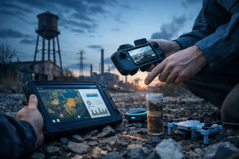
Technology is changing Phase 1 environmental site assessments by improving how evidence is located, organized, mapped, and documented—so conclusions are more traceable, defensible, and easier to explain. In practice, technology used in phase 1 environmental site assessments helps practitioners connect historical records to present-day conditions, reduce uncertainty around “what was where and when,” and communicate limitations clearly. For 2026, the key shift isn’t that software “finds contamination,” but that it increases the amount and quality of usable information while still requiring professional judgment under established standards.
This article breaks down what’s actually changing: how modern tools strengthen the records review and site reconnaissance, what innovation categories matter most (like GIS, drones, and digital evidence platforms), and how to choose a technology stack that stays within Phase 1 scope. You’ll also see common misconceptions and an evaluation framework for comparing two Phase 1 ESAs that used different tools—so you can spot defensibility, not just polished maps.
How Technology Is Improving Phase 1 ESA Evidence Instead of Just Making Reports Faster
Technology improves Phase 1 environmental site assessments by making the evidence trail clearer—what was checked, where it came from, and how it supports the conclusions. The real value is not “faster reporting,” but better linkage between historical/current use narratives, maps, and the basis for identifying potential release scenarios.
Before modern tooling, many Phase 1 ESAs relied heavily on manual compilation: scanned documents, handwritten notes, and static maps assembled late in the process. Today, practitioners increasingly use digital workflows to capture observations consistently, manage evidence versions, and produce map-based deliverables that reflect the same assumptions used during records review. That matters because defensibility is about reproducibility: another qualified reviewer should be able to follow the logic and confirm that the findings were drawn from the right sources.
In the records review and historical/current use portions, technology helps practitioners do a more reliable “connect-the-dots” between property boundaries, ownership histories, adjacent operations, and past aerial imagery. For example, GIS layers can keep land-use narratives aligned with parcel geometry, while digital evidence logs can document why a record was accepted or discounted. A deeper nuance is that technology can increase the number of “potential concerns” because it increases sensitivity: better mapping and broader search coverage may reveal more sites, references, or industrial footprints. That doesn’t automatically mean the site is riskier—it means the practitioner must interpret and triage findings carefully to avoid false positives.
Finally, tradeoffs are real. More tools can mean more inputs, and not every dataset is equally reliable. If a project team fails to document tool limitations, uses mismatched coordinate systems, or treats imagery as ground truth, technology can actually reduce defensibility. A practical takeaway is that the best technology-assisted Phase 1 ESA is still standard-driven—ASTM E1527-21 methodology governs how evidence is used, and professional judgment governs what it means. This is aligned with the U.S. framework for Phase 1 expectations described in EPA’s overview of brownfields and environmental assessments and the ASTM approach embedded in widely used Phase 1 practice.
Deeper insight: A common mistake is assuming “more evidence sources” equals “more accuracy.” If sources conflict and the report does not clearly document how conflicts were resolved, the report may look comprehensive but not be defensible. What many guides get wrong is implying that technology itself guarantees compliance; software doesn’t replace the requirement to apply an ASTM-aligned process and to transparently state limitations.
What’s Changing in Records Review with Digital Evidence, Audit Trails, and Data Platforms
Technology is reshaping the Phase 1 records review by improving how evidence is organized, validated, and traceable from source to conclusion. With digital evidence management and data platforms, practitioners can show exactly what was reviewed and how it influenced the assessment.
Digital workflows can enhance records review in several concrete ways. First, they provide structured intake of documents (e.g., chain-of-custody for what was received, file versioning, and searchable metadata). Second, they improve traceability: an evidence log can link each record to a finding in the narrative, so reviewers and stakeholders can verify whether the support exists for every important statement. This becomes especially important in complex properties where ownership transfer records, zoning changes, and historic land-use references are messy and partially redundant.

Practically, modern data platforms can overlay property boundary inputs onto historical aerial imagery and parcel layers with consistent coordinate systems, making it easier to check whether “nearby” records truly relate to the subject property’s location. Platforms may also provide address-to-parcel matching, deed/cadastral linkages, and validation flags for mismatched data (such as a record tied to a previous address but a current parcel that does not align). The defensibility benefit comes from reducing unnoticed assumptions—especially “parcel drift,” where an old description does not map cleanly to a modern boundary without careful transformation and QA/QC.
How it connects to 40 CFR Part 312 (AAI conceptually): the AAI framework emphasizes thoroughness and documentation as part of satisfying the broader expectation for environmental due diligence. While Phase 1 ESAs follow ASTM E1527-21 methodology, the conceptual alignment is that good documentation and careful decision logic help demonstrate that the assessment was performed in a way that can be understood and revisited. For context on the regulatory landscape underlying AAI concepts, see eCFR 40 CFR Part 312.
Deeper insight: A key edge case involves boundary mismatches. If parcel geometry is off by even a modest amount, “adjacent property” records may be incorrectly included or excluded, which can ripple into the potential release scenario narrative. What most guides get wrong is treating boundary alignment as a one-time setup step; in reality, defensible workflows use provenance logs, coordinate system controls, manual QA/QC checks, and explicit limitations language when perfect alignment cannot be achieved.
Tradeoffs include licensing limits on proprietary datasets and variable quality of historical imagery. A responsible team verifies critical evidence against primary records when possible rather than relying entirely on secondary map layers. In other words, the platform accelerates the process, but it does not replace the need to understand source quality.
How GIS, Drones, and Geospatial Analytics Are Changing Field Reconnaissance
Technology supports smarter field reconnaissance in Phase 1 ESAs by standardizing how observations are captured, located, and compared against records review inputs. GIS and geospatial analytics make it easier to turn “walkover notes” into map-based, evidence-aligned documentation.
GIS is one of the most practical tools for coordinating field observations. Practitioners can geotag observations, layer land-use features, and standardize note-taking so that the final deliverables reflect the same assumptions used during records review. For example, a practitioner can note the presence or absence of building footprints, former structures, surface conditions, or access constraints directly onto a map layer. This reduces the risk that the narrative and the map contradict each other—an avoidable defensibility issue.
Drones can add value in certain contexts, particularly when ground access is limited, when surface conditions at the perimeter are difficult to document safely, or when structures need clearer visual documentation. In a Phase 1 setting, drones are typically used to capture visual context rather than to “discover contamination.” The key is staying within scope: Phase 1 is about historical/current use and visual evidence in support of potential release scenarios, not intrusive investigation.
Geospatial analytics also helps interpret change over time. By comparing aerial imagery across different dates, teams can identify likely former industrial footprints, evidence of demolition, vegetation changes, or inconsistencies between “what should be there” and “what the imagery suggests.” The deeper nuance is that better imagery does not automatically yield better conclusions. Professionals still apply judgment to interpret what imagery shows (and what it cannot show, such as underground conditions) and reconcile discrepancies with records review.
Deeper insight: Common mistakes include relying on drone imagery without ensuring scale calibration, letting cloud cover or seasonal vegetation obscure relevant features, or over-interpreting patterns that are not supported by records. What most guides get wrong is framing geospatial analytics as an “evidence upgrade” that eliminates uncertainty. In reality, geospatial outputs must be correlated back to records review, with limitations clearly stated when imagery cannot confidently resolve structures, drums, pits, or other Phase 1-relevant indicators.
Tradeoffs include data accuracy: GPS offsets, obstructions, and coordinate system mismatches can shift where observations “land” on the map. That is solvable with QA/QC, but it underscores why defensibility is process-based, not tool-based. A good technology-enabled workflow can turn reconnaissance into a clearer, audit-friendly map narrative—without changing Phase 1’s fundamental scope.
When GPR and Other Noninvasive Tools Can Support Phase 1 (Without Turning Into Phase 2)
Noninvasive tools like GPR can support a Phase 1 ESA when they help interpret potential release pathways or clarify observations that records review cannot resolve by itself. However, they should complement, not replace, the ASTM E1527-21-aligned methodology.
The boundary between Phase 1 and “other site investigations” is critical. Phase 1 is designed to identify recognized environmental conditions and potential release scenarios through records review and visual/observation-based reconnaissance. Technology such as GPR may be used to understand subsurface context in limited ways, but the results must be framed as supportive screening—because GPR signal ambiguity, utility interference, and the limits of noninvasive interpretation can lead to incorrect conclusions if treated as definitive evidence of contamination.
Practical application looks like this: after records review flags a former storage area or potential release scenario, the practitioner may use an adjunct noninvasive method to help interpret where features or buried utilities are likely located. The decision logic should be explicit. The team documents why the adjunct method is appropriate, what it can reasonably detect, and what it cannot. Then it ties outcomes back into the Phase 1 recommendation for whether further targeted assessment is warranted.
Defensibility depends on documentation of tool selection rationale and limitations. A qualified professional should describe survey constraints, resolution limits, and any interference encountered. If the results are inconclusive, that uncertainty should be communicated rather than forced into a definitive “yes/no” statement that the method cannot support.
Deeper insight: An edge case involves utilities. In urban properties with dense subsurface infrastructure, GPR returns can reflect buried lines and voids unrelated to historical releases. Common mistakes include using GPR results to “confirm” a release without corroboration, or skipping limitation statements in the report. What most guides get wrong is blurring screening support with investigative scope creep—turning Phase 1 into a de facto Phase 2 by repeatedly collecting subsurface evidence without an appropriately framed rationale.
Tradeoffs include interpretive uncertainty and the need for qualified interpretation. The most defensible approach is not “more probing,” but “right question, right tool, right documented limits,” followed by Phase 1 recommendations that remain within ASTM E1527-21 scope and decision expectations.
How to Choose a Technology Stack for a Defensible Phase 1 ESA: A Process-First Decision Path
You should choose technology for a Phase 1 ESA based on how it improves evidence alignment, traceability, and interpretation—not based on which tools sound most advanced. A defensible selection process starts with records review needs and ends with field support only where justified.
A practical decision path begins with records review depth. If a property has complex ownership history, inconsistent address records, or significant industrial change, prioritize digital evidence organization, dataset validation, and boundary matching controls. Next comes mapping and evidence integration: ensure GIS and parcel layers use consistent coordinate systems and that imagery overlays are reproducible. Then evaluate field reconnaissance needs: if access constraints or perimeter documentation challenges exist, geotagging and standardized capture workflows can increase clarity.
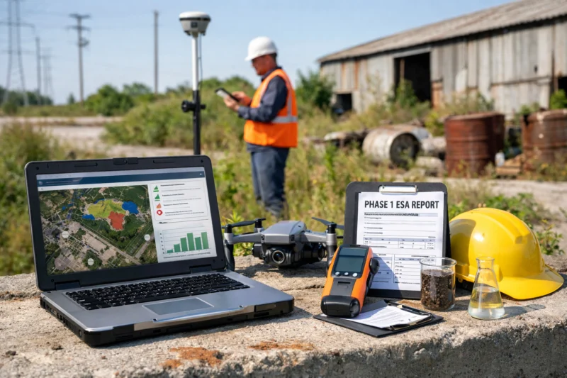
Finally, consider targeted noninvasive support only when the scenario warrants interpretation beyond visual observation. The technology used in phase 1 environmental site assessments becomes a toolset that must serve ASTM E1527-21 and, conceptually, the AAI documentation expectations for thoroughness. In other words, the technology stack should support the narrative logic: records review triggers a potential release scenario, reconnaissance checks for visual indicators, and any adjunct method (if used) clarifies uncertainties with documented limitations.
Quality controls should be part of vendor/consultant evaluation. Ask about QA/QC for geospatial layers, evidence logs that include provenance and timestamps, and how they handle conflicting records. Peer or technical sign-off practices matter too, because many technology errors are not technical “bugs” but workflow gaps—like failing to update boundaries after parcel mapping revisions or overlooking that a dataset’s resolution makes certain interpretations unreliable.
Deeper insight: A common misconception is “tech ROI” being synonymous with “more tools.” In reality, ROI for Phase 1 is uncertainty reduction and defensibility: fewer undocumented assumptions, clearer uncertainty language, and consistent alignment between maps and narrative. What most guides get wrong is recommending a generic tool bundle. The correct approach depends on property complexity—redevelopment sites, mixed-use properties, rural/agricultural parcels, and urban corridors each stress different parts of the workflow.
Tradeoffs include implementation complexity and data licensing constraints. Some “integrated platforms” can reduce manual work but may also increase reliance on third-party data. The safest strategy is to require transparent evidence provenance and explicit limitations language, so stakeholders can see what was verified versus what was inferred.
Common Misconceptions and Pitfalls When Using Technology in Phase 1 ESAs
The most common failure with technology in Phase 1 ESAs is assuming it automatically increases accuracy and defensibility. In reality, technology can introduce new error modes—especially when datasets are mismatched, evidence provenance is unclear, or results are over-interpreted.
One major misconception is “more data equals higher accuracy.” If a team pulls in many datasets without consistent validation, it can increase confusion rather than clarity. For example, multiple historical sources may reference similar-looking parcels or addresses but refer to different properties due to boundary changes over time. Without a robust evidence log and conflict resolution approach, the final report can contain a dense narrative that is hard to defend.
Another pitfall is treating aerial imagery as ground truth. Resolution limits, seasonal variations, shadows, and vegetation cover can hide relevant features or create misleading artifacts. A common example is identifying what appears to be a former structure footprint on imagery, then failing to reconcile it with historic land-use records or present-day observations. The defensibility problem is not just that an interpretation could be wrong—it’s that the report may not document why the practitioner chose one interpretation over another.
Boundary alignment issues are especially risky. When parcel geometry is off, “adjacent property” assumptions can become incorrect. Those errors propagate through the report narrative, potentially influencing which potential release scenarios are considered likely. Technology can mitigate this with provenance logs and QA/QC, but it cannot guarantee correctness if boundary control is weak or if coordinate system decisions are inconsistent across layers.
Deeper insight: A documentation gap is an edge case that often goes unnoticed. Even if the underlying tools performed well, if the report lacks evidence provenance, timestamps, and source descriptions, the benefits may not translate into defensibility. What most guides get wrong is implying compliance is software-based. ASTM E1527-21 expectations are about methodology, documentation, and professional interpretation—standards don’t disappear because a vendor uses a modern platform.
Tradeoffs also include compliance and policy expectations. Some teams may assume that using a GIS interface “satisfies” mapping expectations, but standards govern how evidence is gathered and used. The right question to ask is whether the final ESA demonstrates traceability and transparent limitations, not whether it includes a sophisticated dashboard.
Options and Alternatives: Comparing Technology Approaches While Keeping Phase 1 Scope Aligned
You can compare Phase 1 technology options by evaluating how each approach improves evidence organization, observation capture, and defensible decision logic—while staying within Phase 1 scope. A good technology plan is “fit for purpose,” not “best-of-everything.”
Consider four practical approach categories. First is a document-first digital workflow: strong records review organization plus mapping outputs that remain consistent with the evidence log. Second is geospatial-first field support: a GIS/drone emphasis that improves how observations are captured and located, often helpful for large parcels or complex perimeters. Third is targeted adjunct methods: minimal noninvasive screening only when records review leaves critical ambiguity that visual observation cannot resolve. Fourth is an integrated evidence platform: an end-to-end system that coordinates evidence collection, geospatial layers, traceability, and deliverable generation with audit-friendly outputs.
Which approach fits depends on property type. Redevelopment sites often benefit from integrated evidence platform workflows that reconcile changing parcels and demolition histories. Mixed-use and urban corridor properties may benefit from geospatial-first field support to standardize reconnaissance across dense boundaries and complex land uses. Rural/agricultural parcels may require document-first workflows to manage lower-resolution imagery and variable utility-record availability. In all cases, scope discipline matters: premium tools must not expand investigative scope without the proper recommendations and framing.
When evaluating vendors and teams, focus on evidence traceability, QA/QC, transparency about limitations, and alignment with ASTM E1527-21. A defensible proposal should explain how tools support the methodology and should provide sample deliverables such as evidence logs, map layers, and a sample “limitations” section that shows how they handle uncertainty. If a provider can’t show how they document tool limitations and decision rationale, the technology may be a black box rather than a defensibility aid.
Deeper insight: An edge case is “premium approaches” that unintentionally broaden scope. For instance, extensive adjunct geophysics can start to look like a Phase 2 activity if recommendations are not carefully framed and limitations are not clearly communicated. What most guides get wrong is recommending tool-driven escalation rules (e.g., “use X tool whenever imagery looks suspicious”). The correct approach is evidence-driven and standard-driven: technology should support the rationale for recommendations, not substitute for it.
Edge Cases and Objections in 2026: What Most Guides Get Wrong About Tech-Assisted Phase 1 ESAs
Many guides overpromise what technology can do in Phase 1 ESAs, especially in edge cases like incomplete digitized records or rapidly changing land use. In 2026, the best practice is to treat technology as an evidence-management and visualization advantage while keeping standards-based interpretation and documentation central.
Consider properties with limited digitized records. Some rural or older parcels may not have robust online archives or consistent address data. A defensible team can still meet documentation expectations by using alternative record retrieval methods (such as contacting local repositories), documenting gaps explicitly, and clearly explaining how those gaps affect confidence in the historical narrative. The point is not that technology can “solve” missing records; it’s that a technology-assisted workflow can record the effort, sources searched, and limitations encountered so the report remains transparent.
Another 2026-relevant edge case is rapidly changing land use—construction, demolition, and site clearing that can make older imagery seem inconsistent with current observations. Technology helps reconcile timelines by organizing evidence by date and aligning imagery overlays with known project phases or permitting evidence. But technology can’t magically determine whether a buried feature still exists. Professionals must resolve conflicts carefully and document how they weighed historical records against present-day reconnaissance.
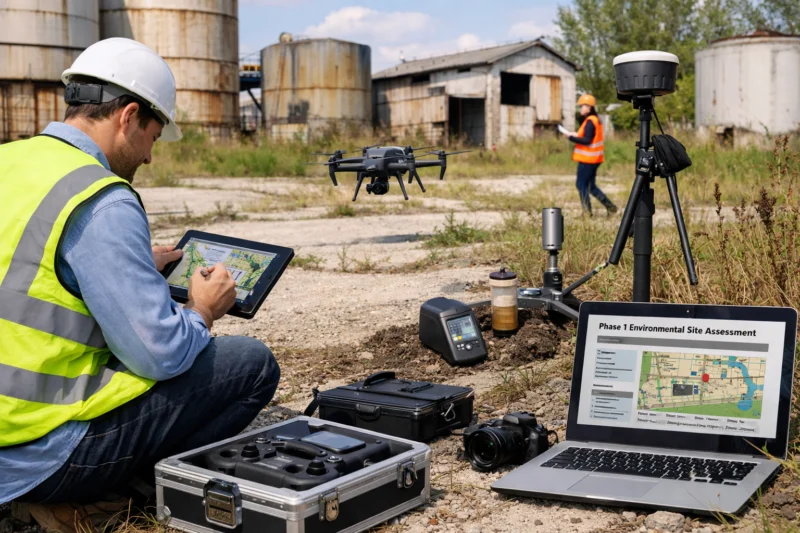
An objection you may hear is: “Will technology replace the Phase 1 professional?” The practical answer is no. Technology changes evidence capture and integration; it does not replace professional judgment, standards-based interpretation, or the need to frame potential release scenarios appropriately. What most guides get wrong is assuming the presence of GIS layers or drone photos reduces the need for careful reasoning and limitations language.
Deeper insight: Conflict resolution between records review and field observations is a common stress point. For example, imagery may suggest a former industrial footprint, but current site conditions show redevelopment and no visible indicators. Technology can help reconcile discrepancies through layered timelines and geotagged documentation, but it cannot eliminate uncertainty. Defensibility comes from documenting the decision path: what evidence was prioritized, what was discounted, and what recommendations were made as a result.
Finally, secure data handling is an increasingly practical expectation. Digital workflows rely on storing evidence and geospatial layers; teams must maintain evidence integrity and reproducibility so that future reviewers can understand how outputs were produced. The goal is not to claim “new compliance,” but to ensure operational discipline that supports auditability and repeatable interpretation.
Why U.S. Geography and Regulation Context Still Matter When You Use Modern Tools
The U.S. context matters because Phase 1 ESAs and AAI-related expectations are built around standards and regulatory frameworks that are widely applied nationally, even when data quality varies by region. Technology choices must reflect local realities such as record availability, parcel mapping systems, and imagery characteristics.
ASTM E1527-21 methodology is commonly used in the U.S., and the AAI concept associated with 40 CFR Part 312 informs how thorough documentation is expected. Technology may enhance traceability, but it does so within a U.S.-anchored process and within jurisdiction-specific availability of records. This is why two ESAs for similar property types can end up with different levels of confidence when one region has strong utility databases and consistent parcel mapping while another does not.
Regional data variance can also distort comparisons between two Phase 1 ESAs that both used “modern tools.” For instance, one team might have access to higher-resolution historical imagery and more complete historical address linkages, while another may be limited by dataset licensing or lower-resolution aerial coverage. The right way to compare reports is not by tool names, but by evidence quality, limitations transparency, and how conflicts were resolved.
Deeper insight: Rural parcels are a helpful example type. They often face lower-resolution imagery, different utility-record availability, and parcel boundary definitions that may be harder to map consistently. Urban areas may have better records but more subsurface complexity, which can create geospatial and interpretive challenges for field reconnaissance and adjunct screening. What most guides get wrong is treating geospatial tools as universally equivalent across regions. In reality, the same technology can produce different reliability depending on local dataset completeness and coordinate accuracy.
For broader regulatory and site assessment context, the EPA brownfields program provides useful background on how communities address redevelopment and environmental risk, reinforcing why thorough and transparent assessments are central to responsible real estate decisions.
Frequently Asked Questions About How Technology Is Revolutionizing Phase 1 Environmental Site Assessments
Does using GIS or drones automatically improve a Phase 1 ESA?
No. GIS and drones can improve documentation quality when they are used with ASTM E1527-21-aligned methodology, correct coordinate systems, and transparent limitations. If a report doesn’t document evidence provenance or reconcile mapping assumptions with the records review, the added visuals may not increase defensibility.
What data sources are considered most reliable for the records review portion?
Most reliable sources are those that directly document site history, such as primary property records and official records tied to the parcel’s location and dates. Secondary sources can help, but strong reports evaluate conflicts, explain discrepancies, and document why certain records were prioritized over others.
How do map overlays and parcel boundary matching affect Phase 1 conclusions?
Parcel boundary matching can materially affect which adjacent properties are considered relevant and which nearby historical uses are included in the assessment narrative. Coordinate system mismatches or “parcel drift” can cause errors that propagate into potential release scenario descriptions, so defensible workflows include QA/QC and limitation language when exact alignment is not possible.
Can noninvasive tools like GPR be used during a Phase 1 ESA?
They can sometimes be used as adjunct support when the methodology remains consistent with Phase 1 scope and the results are interpreted with documented limits. If GPR is used, the report should describe survey constraints, interpretive uncertainty, and how outcomes influenced next-step recommendations.
What’s the difference between Phase 1 and “tech-assisted screening” that looks like Phase 2?
Phase 1 focuses on records review and observation-based reconnaissance to support the identification of potential release scenarios. “Tech-assisted screening” becomes Phase 2-like when the work shifts toward exploratory subsurface investigation without proper framing, documentation of limitations, or appropriately scoped recommendations.
How do technology workflows support ASTM E1527-21 documentation and defensibility?
Strong workflows create traceability through evidence logs, version control, and consistent mapping assumptions across the report narrative. They also make limitations and uncertainty easier to communicate, such as when datasets are incomplete, imagery is unclear, or boundary alignment has known constraints.
Will technology increase the number of “potential releases” identified in Phase 1?
It can increase the number of “potential” concerns because broader and more sensitive searches may reveal more leads. However, defensible reports triage findings using professional judgment and clearly explain uncertainty so that sensitivity does not automatically translate into overstatement.
What should I ask a consultant to confirm about their “technology used in phase 1 environmental site assessments”?
Ask how they validate datasets, how they handle parcel boundary alignment and evidence provenance, and how they document tool limitations. Request sample deliverables such as an evidence log, QA/QC notes for geospatial layers, and a brief example of how the report explains uncertainty and decision logic.
How should I compare two Phase 1 ESAs when one used newer mapping tools?
Compare evidence quality and traceability, not just map polish. Look for how each report documents source reliability, resolves conflicts, states limitations, and aligns visual observations with the records review narrative. A newer tool is helpful only if the evidence trail is clear and reproducible.
What happens if the aerial imagery contradicts the current site observations?
A defensible Phase 1 ESA documents the discrepancy and explains how the practitioner weighed the records and the present-day observations. If the conflict suggests meaningful uncertainty about historical use or potential releases, the report should discuss whether additional targeted assessment is appropriate—without jumping into expanded scope without justification.
How does 40 CFR Part 312 (AAI concept) relate to modern Phase 1 evidence documentation?
While Phase 1 itself is built on ASTM methodology, AAI concepts emphasize thoroughness and documentation. Modern technology can support that goal by improving traceability and auditability, but it does not change the underlying need for professional judgment and transparent limitations.
Conclusion
Technology is revolutionizing Phase 1 environmental site assessments by strengthening evidence capture, integration, and documentation—so conclusions are easier to understand, verify, and defend. GIS workflows can improve how field observations map to records review; digital evidence platforms can reduce undocumented assumptions; and adjunct noninvasive tools (when justified) can clarify uncertainty with careful limitations language.
At the same time, the discipline remains unchanged: a defensible Phase 1 ESA is standards-based and judgment-based. Technology used in phase 1 environmental site assessments should serve ASTM E1527-21-aligned methodology and support transparent decision logic, not expand scope by default or replace professional interpretation.
If you are selecting a provider, the best next step is to request an evidence log sample, QA/QC practices for geospatial layers, and clear language on tool limitations and conflict resolution. To keep expectations grounded, consult a qualified environmental professional to align the technology stack with the site’s history, complexity, and Phase 1 scope—so the deliverable improves defensibility, not just appearance.
Updated August 2026