
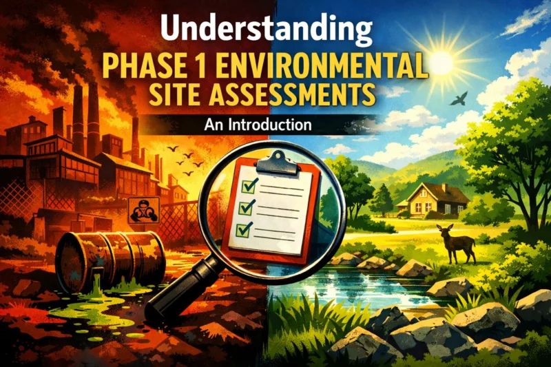
A Phase 1 Environmental Site Assessment (ESA) is a due diligence tool used to identify whether past or present property conditions indicate likely environmental contamination, so stakeholders can decide whether they need further investigation. In other words, it helps you answer what is a phase 1 environmental site assessment—not by running default sampling, but by building a defensible, evidence-based picture of environmental risk and setting the stage for any Phase 2 work. If you are buying, financing, refinancing, or managing property, Phase 1 findings influence risk management, negotiation posture, lender/insurer expectations, and regulator conversations. This introduction explains what Phase 1 is designed to accomplish, how it fits into the ASTM and “all appropriate inquiry” (AAI) framework, and why its conclusions hinge on documentation quality rather than dramatic lab results. In 2026, the core technical and documentation backdrop remains ASTM E1527-21 and the AAI concepts associated with 40 CFR Part 312.
What a Phase 1 ESA is designed to accomplish in due diligence
A Phase 1 ESA is designed to identify Recognized Environmental Conditions (RECs)—and often Historical RECs (HRECs) or controlled RECs—based on records, interviews, and site reconnaissance. Its job is not to “confirm contamination” the way a Phase 2 would; instead, it determines whether contamination is plausible enough to warrant more investigation. Readers typically use Phase 1 to make better decisions about whether to proceed with a transaction, adjust terms, or commission targeted sampling.
Why this matters is simple: environmental uncertainty can become a financial and legal uncertainty. If a property has a history of industrial operations, fuel storage, certain manufacturing, dry cleaning, or known releases—even if those activities ended years ago—the buyer and lender want to understand the likelihood that contamination could be present now or could migrate onto the site. A well-prepared Phase 1 report gives stakeholders a structured, auditable basis for risk assessment, which is also useful for negotiation (for example, requesting repairs, credits, escrow, or indemnity language).
How it works in practice is evidence-driven. The assessor researches historical land use, reviews regulatory and other records, interviews knowledgeable persons, and performs a visual reconnaissance during a site walk. The assessor then synthesizes the evidence into conclusions: the presence or absence of RECs, plus whether there are issues that may affect the likelihood of release or migration pathways. This decision pathway is often summarized as Phase 1 → interpret findings → decide whether Phase 2 is appropriate.
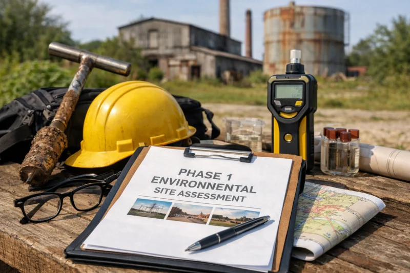
In real-world scenarios, think of a mixed-use purchase in a dense commercial area. Even if the current tenant runs an office and “nothing smells,” Phase 1 may flag RECs based on past tanker deliveries, former fuel service, abandoned underground storage tank indicators, or historical industrial tenants. Conversely, “no RECs” can be meaningful—but it is not a guarantee of no risk. The report’s limitations (such as incomplete historical addresses, inaccessible areas, or gaps in digitized archives) shape how confidently stakeholders can rely on the conclusion.
Common limitations are where people misread the outcome. A Phase 1 is built on historical documentation and observable evidence at the time of the walk. If records are missing or redevelopment has obscured earlier land use markers, the assessor may document uncertainty rather than assume safety. That uncertainty is itself a practical outcome because it tells you what data gaps should be addressed in Phase 2 (if needed) or in a narrower targeted investigation.
Understanding the Phase 1 ESA framework: ASTM E1527-21, AAI, and what “compliant” really means
“Compliant” Phase 1 typically means the report follows the methods, documentation expectations, and interpretive conventions of ASTM E1527-21, and that the work supports the broader “all appropriate inquiry” (AAI) concepts used in the liability framework under 40 CFR Part 312. Put plainly: the standard shapes how the assessor researches, documents, and describes uncertainty so the findings are defensible. It does not turn Phase 1 into a contamination guarantee; instead, it turns due diligence into an evidence-based process.
ASTM E1527-21 is the core technical standard that influences what records are reviewed, how interviews are structured, what site reconnaissance looks like, and how the report is organized. Stakeholders often care about ASTM alignment because it affects whether the work product can stand up under scrutiny from lenders, insurers, attorneys, and regulators. When a report clearly explains sources, assumptions, and limitations, it becomes easier to evaluate what the assessor concluded and why.
AAI, as referenced through 40 CFR Part 312, frames how due diligence can support liability protections under CERCLA-related concepts. In practical terms, this means the timing of the work, the completeness of inquiries, and the quality of documentation can matter when stakeholders argue they acted responsibly based on appropriate inquiry. A key takeaway for 2026 is that AAI expectations focus on the overall diligence process, not only on the label “ASTM Phase 1.”
How “compliance” looks operationally includes assessor qualifications, a defined scope and limitations section, clear interview summaries, and documented attempts to locate relevant records. It also includes a disciplined approach to evidence quality: the assessor should explain what could not be verified, how conflicting sources were handled, and how conclusions were reached. Reports that include a robust narrative and a traceable evidentiary trail are generally more defensible than reports that simply check boxes.
The limitation that surprises first-timers is the difference between “met ASTM steps” and “met real-world risk expectations.” For example, an assessor may have performed the required research steps, but if key historical addresses were unavailable or access was denied to critical areas, the report might still recommend caution or additional research. In those cases, “compliant process” does not eliminate residual uncertainty; it simply makes that uncertainty explicit.
For context and deeper reading, the underlying liability framework is described by the EPA’s AAI rule materials in 40 CFR Part 312, and ASTM E1527-21 details the Phase 1 methodology. You can also see general background on ESA concepts from EPA’s Brownfields and site assessment resources, which helps connect due diligence to environmental cleanup planning and community redevelopment. Helpful starting points include EPA AAI rule overview, EPA Phase 1 ESA background, and ASTM E1527-21 overview materials.
The typical Phase 1 ESA process: from interviews and records to site reconnaissance and conclusions
A typical Phase 1 ESA follows a structured workflow: background research, records review, interviews, site reconnaissance, and then documented conclusions about whether RECs are present. The process is designed to be repeatable and evidence-based, so different stakeholders can understand what drove the findings. In most cases, Phase 1 involves no invasive sampling, but it can still identify the need for Phase 2.
How it works begins with background research. The assessor reviews historical land use and chains of ownership to understand what kinds of activities occurred on-site or nearby. This often includes reviewing aerial imagery, historical maps, city directories, permits (when available), and documented changes such as re-zoning, redevelopment, demolition, or reconfiguration of parcels. The goal is to translate “what the property used to be” into an evidence set that can be compared to known environmental hazards associated with those activities.
Next comes regulatory and agency records review. The assessor searches for information that could indicate releases or operations of concern, such as records related to hazardous materials, underground storage tank programs, solid waste handling, or other regulated activities. Interviews then fill in the human details: what former owners and occupants recall about spills, fuel deliveries, waste disposal practices, equipment removal, or changes in operations. In practice, interview quality depends on who is interviewed and what they realistically know.
Site reconnaissance ties the desk research to visible conditions. The assessor walks the property (and in many cases reviews adjacent areas that could influence migration or off-site impacts). They look for evidence such as staining, stressed vegetation, drums or waste storage, signage for hazardous materials, indications of former tanks or piping, surface impoundment remnants, and drainage patterns that could carry contamination. Even though this is not sampling-by-default, observable indicators can still drive a REC conclusion.
The findings logic is where many reports succeed or fail. A good Phase 1 explains how evidence was weighted, how inconsistencies were resolved, and why a particular REC classification was chosen. For deeper insight, consider evidence quality issues: stale aerials that do not capture recent redevelopment, incomplete address lists that miss a former operator, or conflicting information across directories and ownership records. When these occur, the assessor should document how gaps were handled rather than quietly smoothing uncertainty.
Edge cases often appear in redeveloped urban parcels where old subsurface features may have been buried or removed. Another common scenario is partial access—when locked fencing or limited permission prevents observing portions of the site. In those cases, the report’s limitations section becomes critical for understanding whether the conclusions reflect the full property or only accessible portions.
How to achieve a defensible Phase 1 ESA conclusion (and avoid an overreach)
A defensible Phase 1 ESA conclusion is one that clearly states whether RECs are present (or absent), explains the evidence supporting those findings, and accurately communicates uncertainty and limitations. It should not overreach into “certainty” about contamination without sampling; rather, it should align its conclusions with what records, interviews, and reconnaissance actually show. If the report recommends Phase 2, it should connect that recommendation to specific evidence types and data gaps.
How assessors achieve defensibility starts with interpretive discipline. The assessor uses professional skepticism: they consider all relevant evidence, weigh source reliability, and examine whether a potential release is plausible based on documented activities and observable indicators. If conditions suggest likely release or migration pathways, the report may classify the situation as a REC, an HREC, or a controlled REC depending on context and evidence. The conclusion is therefore a structured judgment, not a gut reaction.
Practical application for stakeholders is to read the conclusion and recommendations together. “No RECs” can be appropriate when evidence is clean, access limitations are minimal, and historic operations are unlikely to have caused releases. But stakeholders should also look at what could not be verified. For example, if historic addresses were missing or the assessor could not review certain regulated databases due to access, a “no RECs” statement may still come with caveats that suggest targeted follow-up.
Tradeoffs and limitations show up in the scope statement. Sometimes stakeholders try to push Phase 1 beyond its typical function—asking whether it “proves” a specific contaminant issue. A strong report resists that overreach by maintaining consistent terminology: Phase 1 identifies conditions and evidence of likely releases, while Phase 2 determines actual concentrations and migration behavior. If you need certainty for underwriting, permitting, or litigation, you may still require Phase 2.
Real-world scenarios illustrate the nuance. Imagine a property near a former rail-served industrial corridor where off-site releases could migrate into the parcel via stormwater or groundwater. Even if on-site activities look low-risk today, the Phase 1 may still flag RECs based on adjacent sources. Another scenario is a former dry cleaner where historical records are partially incomplete: the assessor may identify an HREC based on what is known and document what is missing, guiding whether Phase 2 should focus on soil or specific media.
What most guides get wrong is treating the report as a pass/fail stamp. A more accurate mindset is “evidence sufficiency for this decision.” A defensible Phase 1 equips you to ask the next question: Is the evidence strong enough that Phase 2 is warranted, or can we manage residual uncertainty another way? The best reports make it easy to follow that chain of reasoning.
Common mistakes and misconceptions about Phase 1 ESAs (what most first-timers get wrong)
One of the most common misconceptions is that Phase 1 ESA tests for contamination. In most cases, Phase 1 is primarily a documentation-and-observation exercise, and testing for soil or groundwater typically occurs in Phase 2 when justified by Phase 1 findings. Another frequent mistake is assuming that a standardized format automatically guarantees quality—report structure matters, but assessor competence, evidence depth, and limitation handling matter just as much.
Why these misconceptions matter is that they shape expectations and can affect transaction outcomes. A seller might feel surprised by a Phase 2 recommendation, while a buyer might feel blindsided when Phase 1 does not provide lab results. When expectations are misaligned, negotiations can become adversarial even when both parties are operating in good faith. Setting the right understanding at the start helps everyone interpret findings correctly.
How the mistake plays out in practice is often visible in scope and reading comprehension. For example, some parties interpret “no RECs” as “no risk at all,” ignoring documented uncertainty or incomplete access. Others focus only on a single paragraph and miss how the report handled conflicting records. A robust Phase 1 does not hide uncertainty—it usually explains it, and that explanation is the leverage point for the next due diligence step.
Overlooking adjacent properties is another classic error. Even if a site’s own history seems benign, off-site sources can create migration pathways through groundwater, stormwater, utility corridors, or shared drainage systems. Phase 1 assessors consider these pathways when evidence supports concern. If stakeholders fail to account for adjacent context, they may underestimate the likelihood that a Phase 2 investigation could be appropriate.
Edge cases include disputes about methodology when historic addresses are missing or when sites are redeveloped. Stakeholders may argue that the assessor did not consider a particular building or did not interview a particular person. Strong reports mitigate these disputes by documenting search efforts, explaining what was and was not verifiable, and showing how the assessor resolved conflicts. If data cannot be verified, the defensible approach is transparency, not omission.
What most first-timers get wrong is believing that “more expensive” always means “better.” Sometimes a better approach is a targeted expansion of research or reconnaissance focused on the specific risk drivers—such as a particular former use corridor—rather than a broad, costly detour. The right question is whether the scope addresses the evidence gaps that influence the REC conclusions.
Phase 1 ESA alternatives and comparison: when you should consider other due-diligence approaches
Phase 1 ESA alternatives are worth considering when property history, known releases, or timing constraints make a full Phase 1-only approach insufficient for decision-making. Stakeholders may choose Phase 1 only, targeted Phase 2, combined strategies, or an enhanced Phase 1 with deeper research and broader reconnaissance. The “best” option depends on risk level and what decision needs to be made with defensible support.
How to think about alternatives is to compare decision outcomes, not just deliverables. For example, if there is a known spill, an active tank permit history, or regulatory enforcement, a pure Phase 1-only route may delay decisions because Phase 1 will likely flag RECs and then trigger Phase 2 anyway. In contrast, when the property history looks low-risk and access and records are robust, Phase 1-only may provide enough evidence to proceed without intrusive work.
In categories, stakeholders often consider: (1) Phase 1 only, (2) targeted Phase 2 sampling, (3) combined Phase 1/2 strategies (especially when time is short), or (4) enhanced Phase 1 (broader research/recon). Lenders and insurers may influence what documentation they consider adequate, and that influence can differ by the risk profile and geography of the collateral. In 2026, many teams want a defensible workflow that matches their underwriting questions, not just a minimal checklist.
Practical application: compare scope statements and uncertainty handling. Ask whether the assessor will explicitly describe access constraints, whether adjacent sources will be addressed, and how findings will be interpreted. For targeted Phase 2, ask how the sampling plan basis is tied to Phase 1 findings, not arbitrary selection. Even if sampling is performed, the Phase 1 context still matters because it provides the evidence trail that justifies sampling locations and interpretive assumptions.
A key tradeoff is performance versus defensibility. A cheaper option that jumps directly to sampling can increase unknown risk if it does not properly map the likely sources, pathways, and exposure areas. That can lead to disagreement later: “Why were those samples taken?” or “Why weren’t other likely source areas included?” The most practical due diligence programs align each step with the evidence chain.
Advanced considerations and edge cases that can change the outcome
Some properties produce Phase 1 outcomes that are unusually sensitive to assumptions, access, or historical complexity—meaning edge cases can materially change whether RECs are identified. Complex land use histories, undocumented fill, restricted access, utility corridors, and redevelopment overlays can all change how evidence is interpreted and where uncertainty must be documented. If you know your site has these complexities, you should plan for them explicitly in the Phase 1 scope.
How complex property histories affect Phase 1 starts with the records chain. Multiple operators and tenants can create a patchwork of activities that are hard to reconstruct from incomplete directories or permit records. Industrial rebranding and name changes can hide relevant operations unless the assessor performs careful cross-referencing. Undocumented fill is another challenge: it can complicate interpretation of what is “original” versus what is imported material, especially if fill was placed to regrade a property.
Access constraints can also shift outcomes. When parts of the site are locked, fenced, or otherwise not observable, the assessor must document what could not be examined and how that limitation could affect conclusions. Stakeholders sometimes want to treat limited access as if it had no effect; defensible reports treat it as an explicit factor. This can lead to recommendations for targeted investigation in later steps.
Utility corridors and subsurface features deserve special attention. A site might have legacy septic/sewer histories, abandoned lines, transformers, or other subsurface infrastructure that can create pathways for contamination even if surface indicators are minimal. In Phase 1, the assessor evaluates these features based on records and observation, and they may recommend Phase 2 if evidence suggests likely releases.
Urban redevelopment and layered land uses create interpretation difficulties. Parcel reconfiguration, demolition, and replatting can mean the current parcel footprint does not match historical operations. Assessors typically reconcile historic land use to the present parcel geometry using maps and aerials, but if documentation is limited, uncertainty must be stated. For deeper insight, consider how stakeholders dispute classifications: when parties challenge whether a condition should be labeled an HREC or a controlled REC, the defensibility often depends on the report’s evidentiary trail and explanation of the basis.
Common mistake in edge cases is assuming that the Phase 1 report will “automatically” resolve the uncertainty. It may not; instead, it should provide clear next-step logic. The best outcome is not a perfect answer, but a clear, evidence-based map of what is known, what is uncertain, and what data would most reduce decision risk.
Technology and modern workflows: how GIS, drones, GPR, and digital data platforms are shaping Phase 1 reporting
Technology is increasingly used to strengthen Phase 1 ESA workflows, especially for records retrieval, mapping, and documentation management. GIS tools, drones (for visual documentation), and digital data platforms can improve how assessors visualize historical land use and current site conditions—but they do not replace the fundamental evidence-based structure of Phase 1. In most cases, advanced tools like GPR and drone capture support observations rather than serving as default contamination testing.
How technology fits without turning Phase 1 into sampling-by-default is a key boundary. GIS mapping helps correlate parcels, property history, aerial imagery, and regulatory datasets into a coherent spatial narrative. That can reduce errors like misaligning historic addresses or missing adjacent influence areas. Digital workflows also improve traceability: better version control for records, structured notes for interviews, and consistent report generation can make it easier to audit how conclusions were reached.
Innovation categories that are especially relevant in modern Phase 1 reporting include digital records pipelines, database-driven regulatory checks, and documentation management platforms. For example, assessors may use digital document repositories to track evidence quality and maintain a consistent audit trail of sources and dates. Some teams also use “data platform” workflows to manage multiple data inputs and generate figures used in the report.
Where advanced tools like GPR or drones come up, it should be handled carefully and within scope. GPR can sometimes assist with identifying subsurface anomalies, but it still requires interpretation and validation, and it may fall outside typical Phase 1 scope if used as a substitute for sampling. Drone imagery can improve observation of large sites, roof conditions, and surface features, but it does not replace records and interviews. The assessor should still explain what the tool did and did not show.
A deeper concern is over-reliance. Automated flags from data platforms can be misleading if coverage is incomplete or if the platform’s interpretation is simplified. A defensible approach validates the data: confirms what the flag references, checks the evidence date, and ensures the platform output is reconciled with narrative context. Documenting data provenance is critical for auditability, especially when data subscriptions or third-party datasets have limits.
Common mistake is treating technology outputs as conclusions. Screen captures, heat maps, or automated “risk scores” should be treated as leads, not as proof. The Phase 1 conclusion should still be anchored to the assessor’s professional synthesis of records, interviews, and on-site observations.
Geography-focused due diligence: how Phase 1 scope can differ by region and local risk context (US-wide)
Phase 1 methods are generally standard-based, but the practical scope and the risk emphasis can vary across regions due to differences in land use history, regulatory footprints, and information availability. In the U.S., the same ASTM framework may lead to different research depth depending on whether the region has dense industrial corridors, common historical fuel practices, or particular patterns of redevelopment. When you understand local context, you can better evaluate what “good” Phase 1 evidence looks like for that property.
How regional risk context changes interpretation includes factors like typical land uses and how evidence persists. For example, some coastal areas may have different migration and visibility patterns due to groundwater behavior and stormwater dynamics. Inland regions may show different evidence longevity for staining, stressed vegetation, or remnants of historic infrastructure. While Phase 1 is not designed to measure contamination, the likelihood that evidence is observable can affect what the assessor can responsibly conclude.
Records gathering also varies by region. Some jurisdictions have strong digitization, while others require more manual research or rely on archival practices that are harder to access quickly. The assessor’s job is to document the search efforts and limitations. In areas with better online records, the Phase 1 report may have richer documentation, whereas in digitization-poor areas, limitations may lead to more uncertainty language.
Anchor scenario (generic U.S.): consider a legacy industrial parcel near rail lines versus a former agricultural parcel with irrigation infrastructure. On the industrial parcel, Phase 1 might focus on historical manufacturing, fuel handling, and spill indicators; on the agricultural parcel, it might emphasize storage practices, chemical usage patterns, irrigation-associated infrastructure, and how drainage changed over time. Different potential source areas and migration pathways mean different evidence priorities.
Deeper insight is the “information availability inequality.” Even when two properties look similar, a county’s record infrastructure can change what is discoverable within the Phase 1 research scope. Good assessors compensate by expanding searches where feasible, documenting what could not be verified, and aligning conclusions with that evidence. A poorly written report may hide gaps; a strong report names them and explains how they affect the recommendation for Phase 2 (if needed).
Why this matters for stakeholders is negotiation and decision clarity. When the report transparently explains regional limitations, stakeholders can better plan next steps instead of debating whether the assessor “missed something.”
Frequently Asked Questions About Understanding Phase 1 Environmental Site Assessments: An Introduction
What is a Phase 1 Environmental Site Assessment used for during a property transaction?
It is used to evaluate whether environmental conditions are likely enough to warrant further investigation, usually by identifying RECs and documenting evidence quality. During a transaction, Phase 1 can influence how parties negotiate risk allocation, pricing, or conditions for closing. Lenders and many due diligence teams also rely on Phase 1 documentation to support underwriting questions about potential contamination liability.
What standards govern Phase 1 ESAs, and how do ASTM E1527-21 and AAI relate?
ASTM E1527-21 is the technical standard that guides Phase 1 methods, report structure, and documentation expectations. AAI concepts under 40 CFR Part 312 relate to how due diligence supports certain liability frameworks, meaning the timing, thoroughness, and evidentiary support of inquiries can matter. In practice, many “compliant” reports clearly describe how they met ASTM methods and how limitations were handled to support defensibility.
Does a Phase 1 ESA include soil or groundwater sampling?
Typically, Phase 1 does not include soil or groundwater sampling; it relies on records, interviews, and site reconnaissance. Sampling is usually part of Phase 2 when Phase 1 identifies RECs, likely release indicators, migration pathways, or data gaps. There are exceptions based on project scope and local requirements, but the default intent is non-invasive evidence gathering.
How do assessors determine whether a REC is present?
Assessors weigh evidence from regulatory records, interviews, and observations during reconnaissance. A REC may be identified when evidence suggests a past or present release, a history of potentially hazardous activities, or observable indicators consistent with contamination. The report should explain how the evidence supports the conclusion and what limitations might affect confidence.
What does it mean if the Phase 1 ESA finds no Recognized Environmental Conditions?
No RECs generally means the assessor did not find evidence strong enough to meet the REC definitions based on the reviewed materials and observations. However, the conclusion may still include documented uncertainties, such as inaccessible areas or incomplete historical address information. “No RECs” should be interpreted as “no RECs identified under the scope,” not as proof that contamination is impossible.
How far back does a Phase 1 ESA look into a property’s history?
Phase 1 historical research often looks back to address dates and the period that is reasonably available through records, interviews, and historic documentation. There is no single “always X years” rule; it depends on the property context and the availability of verifiable information. A well-written report explains how historic research was conducted and what could not be confirmed.
Can Phase 1 results be used for liability protections, and what documentation matters?
Phase 1 results can be relevant to liability protections in the AAI framework, but the value depends on how well the process and documentation meet expectations under 40 CFR Part 312 concepts. Key documentation elements include assessor qualifications, the scope and limitations, detailed evidence sources, and transparent uncertainty statements. Timing also matters because AAI considerations can be sensitive to when the inquiry was performed relative to the transaction.
What are common reasons Phase 1 ESAs require Phase 2 follow-up?
Phase 2 is often recommended when Phase 1 identifies RECs or likely release indicators, suggests possible migration pathways, or reveals data gaps that cannot be resolved through records and observation alone. For example, historical fuel storage indicators, suspected underground tank remnants, or off-site sources that could impact the site can drive follow-up. Limited access to key areas can also trigger Phase 2 or additional targeted research.
What should I ask my Phase 1 ESA provider before ordering?
Ask about assessor qualifications, the scope statement, how they align with ASTM E1527-21, and what specific records and interview sources they plan to use. You should also ask how they handle limitations, conflicting information, and gaps in address histories. Finally, request clarity on deliverables—what figures, summary tables, and limitation language you will receive in the final report.
How do limited access, missing records, or conflicting information affect Phase 1 conclusions?
Limited access can prevent observation of critical conditions, so the assessor should document what was not viewed and how that could affect findings. Missing records and conflicting accounts typically increase uncertainty and may lead the assessor to recommend further investigation. A defensible Phase 1 shows how the assessor reconciled contradictions or explained why they could not verify certain details.
Is it better to do Phase 1 only or jump directly to Phase 2 for high-risk properties?
Often, the choice depends on whether Phase 1 is likely to identify RECs and clarify where Phase 2 should focus. For well-documented high-risk scenarios (such as known releases), targeted Phase 2 may be appropriate sooner to reduce decision friction. However, in many situations, a Phase 1 still helps make Phase 2 sampling more defensible by mapping likely source areas, migration pathways, and data gaps.
Conclusion
Phase 1 Environmental Site Assessments build a defensible picture of environmental risk using records, interviews, and site reconnaissance—not default sampling. The core framework remains ASTM E1527-21, and the AAI concepts referenced under 40 CFR Part 312 explain why documentation quality, timing, and transparent limitations matter when stakeholders seek liability-relevant defensibility in 2026. When you read the report with the right mindset, the conclusions become decision tools: whether to proceed, negotiate terms, or advance to targeted Phase 2 follow-up.
Your next step is practical. Review the report’s scope statement, limitations, evidence sources, and the reasoning behind any REC classifications or “no REC” conclusion. Then use the report’s uncertainty language to decide whether additional investigation is warranted and where Phase 2 should focus. Choosing qualified assessors and asking how technology and data quality are handled can help ensure the final product is both useful and defensible.
If you are building a consistent due diligence workflow for future deals, the same discipline applies across reporting and documentation—keep scope clear, evidence traceable, and conclusions tied to what was actually observed and verified. That approach helps you manage uncertainty early, reduce surprises at closing, and strengthen your negotiation posture without overreaching beyond what Phase 1 can responsibly determine.
Updated August 2026