

A “global perspective” for Phase 1 assessments means recognizing that scope, evidence expectations, and reporting defensibility vary across regulators, property systems, and common land-use histories. For readers navigating cross-border diligence, international phase 1 environmental assessments provide a structured starting point for identifying potential environmental conditions (and the data needed to support decisions), but they also come with jurisdiction-specific limits that can change what “good” looks like. Phase 1 is typically used to support acquisition, financing, permitting, or remediation planning—showing what is recognized and where further investigation may be warranted—without concluding that contamination does or does not exist.
This article delivers a comparative decision path you can use to evaluate Phase 1 reports when teams, standards, and records differ by country or region. You’ll learn what typically travels well across borders (and what does not), why two reports can appear similar yet lead to different risk outcomes, and how modern 2026 workflows—GIS overlays, geophysics add-ons, and digital evidence platforms—improve consistency without overstating certainty.
How Phase 1 assessments translate across borders (what “global perspective” really changes)
Phase 1 assessments are meant to identify “recognized environmental conditions” and related concerns that could indicate potential releases, so decision-makers know whether Phase 2 investigations are likely needed. A global perspective changes the practical meaning of that goal: the core concept is similar worldwide, but the triggers, documentation norms, and the defensibility of conclusions can differ sharply by jurisdiction and intended land use.
Globally, the underlying purpose remains consistent—support risk-based decisions by assembling and interpreting historical land-use information, regulatory listings, and site observations. However, the “recognized” part is not purely scientific; it’s also evidentiary and legal. For example, in one jurisdiction, specific environmental agency datasets may be publicly searchable and complete, while in another, the same types of records may be restricted, fragmented among agencies, or stored in local archives with limited digitization.
In practice, this shows up in deliverables. Two Phase 1 reports might both present interviews, map-based context, and a conclusion about whether releases are “suspected” or “observed,” yet they can differ in how comprehensively they searched older land-use periods, how they documented uncertainty, and how they articulated limitations tied to record availability. A key deeper insight is that “equivalent” Phase 1 outputs can still differ in legal defensibility: the same-looking conclusion may be supported by different scope language, different search effort, and different assumptions about record reliability.
When you evaluate a cross-border Phase 1 report, focus on the evidence trail and scope statement, not the label on the first page. What most guides get wrong is treating Phase 1 as a universal checklist; it’s better understood as an evidence-informed decision framework whose outputs depend on what can be found, how it’s interpreted, and how uncertainty is communicated.
Achieving consistent results: a decision path for international Phase 1 assessments
A consistent Phase 1 approach across borders comes from using a decision path: define the intended decision, confirm scope expectations, gather and quality-rate evidence, interpret findings against local realities, and decide whether Phase 2 is warranted. This is where a “global perspective” becomes operational rather than theoretical.
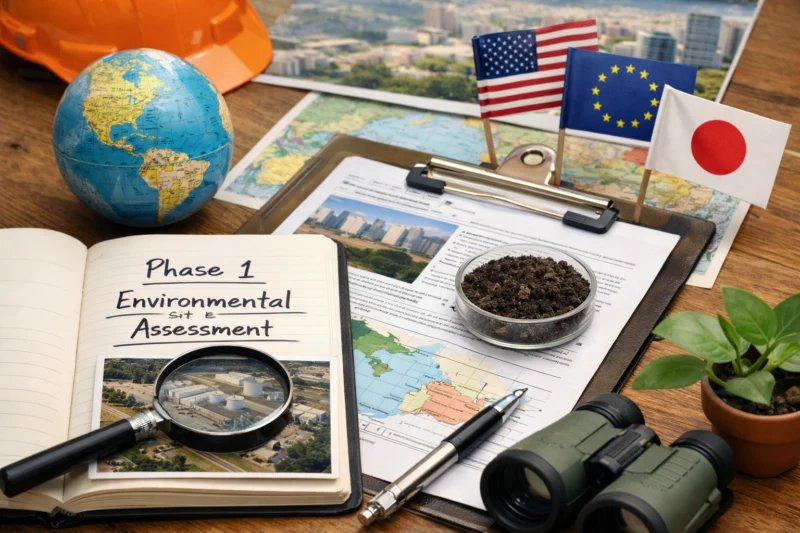
Step one is aligning the Phase 1 work product with the decision it must support. Is the goal lender comfort for a cross-border financing? Redevelopment planning for a mixed-use conversion? Or regulatory engagement ahead of permitting? The intended use shapes what “sufficient” research effort looks like, how uncertainties should be documented, and which risk language will be acceptable for stakeholders. For example, redevelopment planning often demands a clearer connection between historical land uses and future receptors, while financing may prioritize defensible documentation for underwriting.
Step two is confirming scope and standards before research starts. Many international teams use ASTM E1527-21 as a benchmark for organizing terminology and scoping logic, but they then tailor the search plan to match the jurisdiction’s record systems, regulatory databases, and documentation norms. Step three is collecting historical/current data and explicitly tracking data gaps. In international practice, data gaps are rarely small; the key is to record what was searched, what could not be searched (or could not be confirmed), and how that affected confidence.
Interpretation mechanics matter as much as the raw evidence. A strong Phase 1 doesn’t treat findings as a pass/fail checklist; it combines land-use patterns, proximity to known or suspected sources, and the timeline of changes (“what changed when”) to decide whether conditions should be considered recognized or concerning. Edge case: when historical industrial use is known but documentary confirmation is missing (e.g., an old company operated informally or records were never archived), the defensible approach is to require language that communicates “cannot confirm” rather than implying certainty. That limitation language is what helps decision-makers choose next steps without assuming more than the evidence supports.
To make this work internationally, harmonize workflow templates (so scope, evidence quality, and limitations are consistently documented), while still respecting local rules. Most teams underestimate how much variation exists in what counts as corroboration or how interviews should be handled where privacy laws or professional norms differ. The result can be inconsistent risk outcomes even when everyone followed the “same Phase 1 format.”
Standards and regulators: where ASTM E1527-21 and 40 CFR Part 312 (AAI) fit in 2026
In 2026 practice, ASTM E1527-21 and the U.S. framework in 40 CFR Part 312 (All Appropriate Inquiries, or AAI) influence how many Phase 1 teams structure scope, terminology, and limitations—even on international projects. But meeting one standard does not automatically satisfy another jurisdiction’s expectations, especially where record availability and definitions differ.
ASTM E1527-21 is widely used as a practical benchmark because it helps teams organize the report, articulate search effort, and define components like interviews, records review, and documentation of data gaps. Many cross-border practitioners treat it as a “common language” for scoping and reporting, then adapt to local systems where equivalent agency listings may not exist or are maintained differently. The tradeoff is that a benchmark standard can create a false sense of uniformity: you can follow ASTM-style structure while still failing to achieve locally appropriate search depth or acceptable limitations language for that country.
40 CFR Part 312 (AAI) matters in the U.S. because it provides a framework for qualifying protections connected to liability considerations, which pushes documentation rigor and attention to exclusions/limitations. For international projects with U.S. properties or U.S.-influenced financing requirements, teams must be careful about how they translate evidence into conclusions that align with AAI expectations. In that scenario, scope statements and documentation of “no REC” vs “REC suspected/observed” must be consistent with the framework being targeted, not just with general good practice.
A practical international question is what to do when multiple standards appear to apply. The common approach is to identify the primary requirement (what the report must satisfy) and treat other standards as supplemental guidance for methods and organization. A deeper-than-obvious nuance is that teams sometimes assume “ASTM-compliant” equals “AAI-satisfying” (or vice versa). That assumption can fail due to different definitions, different treatment of uncertainty, different expectations about interviews and “search effort,” and different record availability that affects what can be reasonably concluded.
In 2026, digital record access changes how “search effort” is performed: archived maps, historical permits, and agency lists can be more searchable online than in prior years. Still, the defensible practice remains the same—document what you searched, what you relied on, and why—rather than assuming the completeness of publicly accessible datasets.
What data sources and evidence look like around the world (and how to judge quality)
Across the world, Phase 1 evidence usually comes from a mix of historical land use, regulatory and incident records, interviews, and site reconnaissance—but the availability, completeness, and language quality of those sources vary. Judging quality requires tracking provenance, corroboration, and uncertainty, not just compiling documents.
Evidence categories commonly used internationally include historical land use (old cadastral/land registry descriptions, historical zoning or plans), regulatory or agency listings (where available), reported incidents (spills, complaints, enforcement actions), utilities and permitting records, aerial imagery and maps, and interview inputs from knowledgeable persons. Site reconnaissance also matters—especially where modern land conditions could reflect historical practices (e.g., buried infrastructure, subsurface indicators, or signs of past storage).
Regional differences can be dramatic. Some countries have robust land registries with consistent parcel identifiers, while others rely on changing boundaries, municipality-level records, or nonstandard place names across decades. Language and naming challenges also affect searches: corporate predecessor names, transliterations, former municipality names, and rebranded industrial zones can all hide relevant records. Practical application: require a “search terms and mapping” document that records how teams translated place names and company names across time and systems.
Quality rating is where many cross-border reports either become defensible or become misleading. A strong Phase 1 typically presents a confidence or evidence-quality rationale for key findings—what is corroborated, what is inferred, and what remains uncertain. The false-confidence risk arises when publicly available data is incomplete but appears authoritative. For instance, an agency list may not include a historic activity simply because the activity was never recorded there, or because the listing coverage began after the most relevant time period. Most guides miss this subtlety by focusing only on whether a dataset exists, not on whether it covers the relevant era and is complete enough to support conclusions.
Reader outcome: you should be able to ask for an “evidence quality appendix” (or an equivalent section) and interpret it. If the report cannot explain how each conclusion is supported—and what limited the investigation—then “no REC” conclusions may be less reliable than they look.
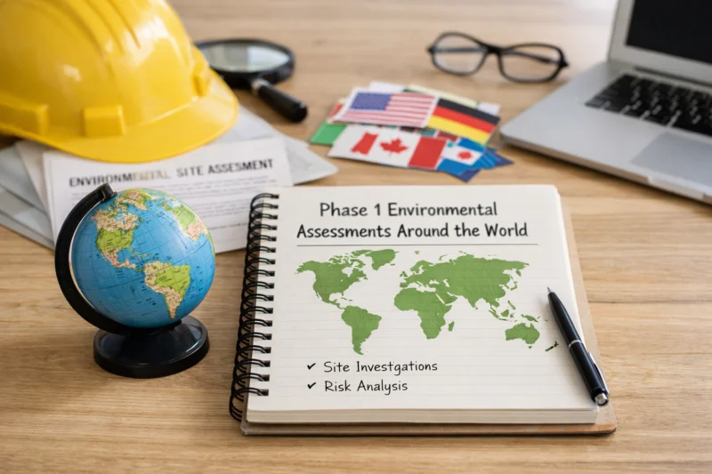
Innovation categories shaping Phase 1 work globally (GIS, drones, GPR, and digital workflows)
In 2026, innovation improves Phase 1 assessments most when it strengthens mapping precision, evidence organization, and targeted field observations—rather than replacing records research or interviews. GIS, drones, GPR, and digital workflows are best viewed as add-on capabilities that support a disciplined decision path.
GIS analytics can enhance Phase 1 by enabling consistent overlays of historical maps, zoning layers, parcel boundary changes, and known environmental features. The practical value is that historical context becomes easier to visualize and less prone to transcription errors—especially in regions where parcel boundaries shift over time. Drones may support visual reconnaissance where permitted, helping teams document current site conditions, surrounding receptors, and evidence of physical features that desktop sources might miss. However, tradeoffs exist: privacy rules, airspace restrictions, and limitations on what imagery can legally be used for can constrain drone deployment. In addition, drones don’t replace the need for record searches—they simply inform what the site looks like today.
GPR and similar geophysical tools can be useful as targeted add-ons, particularly for identifying utilities, buried structures, or anomalies that warrant further attention. The key limitation is interpretive risk: geophysics can increase sensitivity to noise and ambiguous signals. Deeper-than-obvious nuance: the misconception that “more data means better conclusions” can lead to overreach. A well-governed workflow uses decision rules—such as thresholds for when an anomaly triggers a Phase 2 recommendation—and clearly distinguishes “detected features” from “confirmed environmental releases.”
Digital workflows are often the biggest global improvement. Centralized document management, audit trails, version control for evolving parcel histories, and standardized evidence templates help teams maintain consistent conclusions across jurisdictions and team members. But governance is required: data security, privacy compliance, and permissions for handling third-party datasets must be addressed. Optional comparison can help decision-makers understand tradeoffs at a glance.
| Tool category | Typical Phase 1 value | Limitations to document |
|---|---|---|
| GIS overlays | Improves historical mapping context and parcel matching | Depends on map accuracy; boundary conversions can introduce error |
| Drones | Visual reconnaissance of current features and surroundings | Permitting/privacy constraints; imagery interpretation still requires judgment |
| GPR/utility locating | Targeted add-on for anomaly or infrastructure context | False positives; geophysics does not confirm environmental release |
| Digital evidence platforms | Consistent evidence handling and auditability | Access rights and data provenance must be tracked |
Common pitfalls and misconceptions in international Phase 1 assessments
Many misunderstandings come from treating Phase 1 as either “proving no contamination” or as a universally identical report format. In international practice, the most common pitfalls involve scope assumptions, record limitations, and evidence overreliance—leading to conclusions that look confident but are not fully supported.
Misconception one: “Phase 1 proves there’s no contamination.” Phase 1 is designed to identify recognized environmental conditions and related concerns based on available evidence. It does not confirm absence of releases. Even where records research seems thorough, the investigation is limited by record availability, the inability to access restricted datasets, and the fact that not every past release is captured in registries or archives. In cross-border settings, this limitation is often magnified by language barriers or changing record-keeping systems.
Misconception two: “Report format is the same everywhere.” While many reports adopt similar sections—scope, methods, sources, interviews, site observations—the defensibility of conclusions depends on jurisdiction-specific expectations. A report written to satisfy one stakeholder in one country may not use the language or limitations that another stakeholder or regulator expects elsewhere. Practical pitfall: under-scoping due diligence. Teams may skip older time periods, rely on interviews that do not address key phases of land use, or reduce site reconnaissance when records are incomplete abroad.
Pitfall: over-reliance on a single dataset without triangulation. If an agency list is incomplete, a report that treats it as definitive can lead to false reassurance. Deeper-than-obvious nuance: legal-use pitfalls can change how Phase 1 is used across borders. Confidentiality restrictions, professional privilege concepts, and contract scope can affect whether conclusions are shareable with lenders, regulators, or new owners. The practical mitigation is to negotiate engagement terms early—especially around what the report can be relied upon for when the property changes hands across jurisdictions.
Most guides focus on technical data collection but underemphasize contractual and evidentiary “use.” In international projects, that gap can be costly because the report may be technically well-made yet not usable in the way decision-makers need.
Comparisons and alternatives: choosing approaches when “Phase 1” doesn’t fit
When Phase 1 alone cannot support the decision, the right alternative is usually a “scoping ladder” that increases evidence depth—sometimes with targeted sampling, sometimes with earlier Phase 2 intrusion, or sometimes with a regulatory-specific screening step. The key is matching the evidence strategy to risk, not to labels.
Common alternative categories include a hybrid approach: enhanced desktop research plus targeted sampling addendum when there are strong indicators but records are incomplete. Another option is expanding Phase 1 by increasing interview coverage, extending historical time periods, and improving site reconnaissance—particularly where boundaries and place names have changed over time. In higher-risk scenarios, initiating Phase 2 earlier may be appropriate due to known release histories, the presence of likely source areas, or redevelopment plans that will increase exposure pathways. Some jurisdictions also require screening studies that behave like “pre-Phase 2” steps aligned to local regulatory entry requirements.
How to decide between them involves risk profile and decision urgency. If lenders require stronger confidence because the transaction timeline is short and the property history is complex, a hybrid or expanded approach can reduce uncertainty without jumping immediately to full intrusive work. If evidence indicates a high likelihood of a source (for example, legacy industrial operations with documented materials handling), a Phase 2 pathway may be more defensible. Practical application: evaluate sensitivity of surrounding receptors (residential, schools, groundwater users), not just the presence of historic industry.
For credibility, an alternative approach should include methods transparency, uncertainty language, and clear triggers that explain when conclusions can be drawn. Deeper-than-obvious nuance: timing and procurement pressure can push teams to down-scope “just to get it done.” To preserve defensibility, negotiate scope changes explicitly rather than silently shortening older time periods or reducing interview rigor. If scope must change, the report should document the reduced effort and how it affects the reliability of conclusions.
In international settings, alternatives often need tailored communication to multiple stakeholders: a local authority may accept one form of evidence, while a cross-border lender may require more explicit limitations and evidence quality disclosures. Your choice should reflect that chain of reliance.

Advanced edge cases: complex ownership, redevelopment zones, and contested site history
Complex site histories are where Phase 1 assessments either become robust or break down. A global perspective requires special handling for ownership fragmentation, rapid land-use change, contested records, and administrative boundary issues so that Phase 1 conclusions remain defensible.
Complex ownership histories may include absentee owners, short-term leases, and repeated parcel subdivisions over time. In such cases, teams must reconstruct continuity: which parcels correspond to which historic operations, who likely controlled the site during key eras, and how responsibilities may have shifted among entities. Practical application: maintain a parcel crosswalk that ties modern addresses and cadastral identifiers to historical descriptions, along with a narrative explaining how the crosswalk was derived. This also helps align Phase 2 triggers if later investigation is needed.
Redevelopment zones and land recycling add another layer. When a site has undergone multiple transformations—industrial to mixed-use, or fill placement associated with expansion—Phase 1 interpretations must account for changing exposure pathways and altered subsurface conditions. The deeper nuance is that land-use labels can mislead: a “residential” designation today might sit on legacy fill or reworked ground that was not present during older records. A good Phase 1 doesn’t assume today’s use equals today’s subsurface risk; it ties timelines to evidence and explains the implications of land transformation.
Contested or unreliable records can produce conflicting narratives between archives, interviews, and agency listings. The defensible approach is to document the investigation trail: what each source says, which details conflict, and how the conclusion was chosen without hiding uncertainty. Edge case: when records disagree on whether a former activity occurred (e.g., an operation may have moved in or out), the report should avoid forcing a single storyline and instead clarify what can be supported, what is inferred, and what remains unresolved.
Cross-border boundary issues are also common. A site that straddles administrative jurisdictions may require coordinated scope and reporting to avoid double-counting or gaps. Most teams get this wrong by applying one jurisdiction’s documentation template without confirming what each authority expects. A global workflow should explicitly assign responsibility for each jurisdiction’s portion of evidence and ensure the combined report does not create contradictory scope limitations.
Finally, treat “REC-like” conditions consistently. Not all concerns are classic contamination; suspected buried utilities or undocumented tanks may not equal confirmed releases, but they can still justify targeted investigation under a disciplined Phase 1-to-Phase 2 escalation. The goal is consistent reasoning, not turning Phase 1 into unapproved intrusive work.
Frequently Asked Questions About Phase 1 Assessments Around the World
What does a “global perspective” mean for Phase 1 assessments?
A global perspective means the report’s scope and defensibility depend on the jurisdiction’s record systems, stakeholder expectations, and how uncertainty is documented. For example, an investigation that relies on public agency databases in one country may require a different evidence plan where archives are incomplete or access is restricted in another.
How do international phase 1 environmental assessments differ by country or region?
They differ in what triggers documentation requirements, which historical records are available, and how interviews or regulatory listings are handled. Even when two reports follow similar structures, equivalent conclusions may require different search effort because parcel identifiers, naming conventions, and archive completeness vary.
When should a Phase 1 assessment recommend Phase 2 testing?
Phase 1 recommends Phase 2 when evidence indicates a condition that could involve a release or when the evidence gap is significant enough that risk cannot be reasonably screened out. Common triggers include credible historical industrial use, evidence of likely sources, or physical observations suggesting subsurface features that Phase 1 cannot adequately characterize.
Can Phase 1 findings be used for financing or lending decisions internationally?
Often, but acceptability depends on the lender’s criteria and the report’s limitations language, evidence quality documentation, and how conclusions map to their risk framework. Some lenders focus on whether recognized environmental conditions are identified and whether the report clearly explains limits related to record access.
What evidence is most important when historical records are incomplete?
Corroboration becomes critical: interviews with knowledgeable persons, triangulation with imagery and maps, and careful documentation of what could not be verified. If older land use cannot be confirmed through records, a strong report will still explain why that uncertainty exists and how it affects confidence.
How do you handle language barriers and changing place names in global site histories?
Teams use a deliberate search-term strategy that includes transliterations, former municipality names, and corporate predecessor names tied to the property’s history. They also document the mapping logic so readers can follow how different names were connected to the same locations over time.
What are the biggest misconceptions about what Phase 1 assessments can and cannot prove?
The biggest misconception is that Phase 1 proves there is no contamination. In reality, Phase 1 identifies conditions of potential concern based on available evidence; it cannot confirm absence beneath the surface or where records are missing.
How do ASTM E1527-21 and 40 CFR Part 312 (AAI) influence international projects?
They influence how teams structure scope statements, document search effort, and articulate limitations—especially when the project is tied to U.S. expectations. A common mistake is assuming that “meeting ASTM structure” automatically satisfies “AAI expectations” for a specific qualification goal.
What should be included in a strong Phase 1 report for cross-border transactions?
A strong report includes a clear scope statement, methods and evidence sources, interview documentation, mapping context, a limitations section tied to record availability, and explicit conclusion rationale. It should also identify what data gaps exist and how they affect confidence in the presence or absence of recognized conditions.
How can digital workflows improve Phase 1 assessments without overstating certainty?
Digital workflows improve auditability and consistency by preserving data provenance, maintaining audit trails, and controlling version history as new evidence is found. The key is to keep decision rules tied to evidence quality and to avoid treating mapped datasets as confirmation of subsurface conditions.
If a site is high-risk, is it ever appropriate to skip Phase 1?
In most cases, Phase 1 is still a structured way to organize evidence and determine whether intrusive work is warranted. Skipping it may be justified only under specific objectives and documented constraints, such as a regulatory pathway that requires direct Phase 2 or a site history with already-established investigative results.
Conclusion (planning notes for the writer)
Phase 1 assessments worldwide are a structured entry point into environmental due diligence, but “global equivalence” requires careful scope, evidence-quality evaluation, and clear limitations—especially when record systems and stakeholder expectations vary. The practical promise is that a good international phase 1 environmental assessments approach helps decision-makers identify recognized conditions, understand what remains uncertain, and choose defensible next steps.
To keep conclusions credible across borders, think in a decision path: align the assessment to the specific decision being supported, confirm scope and relevant standards up front, rate evidence quality with provenance and corroboration, and interpret findings with explicit uncertainty management. If Phase 2 is needed, the report should explain the trigger logic rather than leaving the reader to infer why investigation should escalate.
For credibility markers that travel well internationally, look for transparent data sources, a defensible scope statement, clear limitations tied to record availability, and a reasoned conclusion structure. When readers and teams can compare these elements across jurisdictions, they’re far more likely to make consistent decisions—even when the underlying datasets differ. If you want help aligning expectations, compare how each report defines scope, documents evidence quality, and explains Phase 2 triggers; that comparison is the fastest way to reduce cross-border uncertainty while preserving defensibility.
Updated August 2026